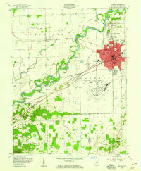
1958 Map of Seymour
USGS Topo · Published 1976About this map
The East Fork White River dictates the landscape of this 1958 survey, winding through the heart of Jackson County. The city of Seymour serves as a major transportation hub, where the Pennsylvania, Baltimore and Ohio, and Chicago Milwaukee St. Paul and Pacific railroads converge. This rail density, alongside the development of the Freeman Municipal Airport, illustrates the area's mid-century importance as a regional transit point.
Find a feature on this map
56 named features on this map. Tap any name to fly to it.
Don’t see what you’re looking for? This feature index may not catch every label — zoom into the map to look around manually.
Map Details
Editions of this 1958 Seymour Map
5 editions found

Other maps of this area

1942 · Franklin
USGS Topo · 1:125,000

1942 · Columbus
USGS Topo · 1:125,000

1948 · Waymansville
USGS Topo · 1:24,000

1953 · Cincinnati
USGS Topo · 1:250,000

1953 · Indianapolis
USGS Topo · 1:250,000

1956 · Indianapolis
USGS Topo · 1:250,000

1956 · Vincennes
USGS Topo · 1:250,000

1956 · Louisville
USGS Topo · 1:250,000

1957 · Indianapolis
USGS Topo · 1:250,000

1957 · Vincennes
USGS Topo · 1:250,000