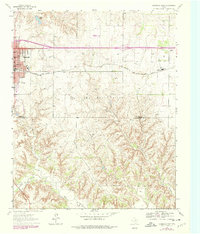
1963 Map of Shamrock East
USGS Topo · Published 1978About this map
Shamrock serves as the primary hub in this Texas Panhandle landscape, where the town’s growth is clearly marked by several educational and recreational sites including North Ward Sch, Jr High Sch, and Central Park. The town sits at the intersection of critical transit corridors, notably the Chicago Rock Island and Pacific railroad and major highways. To the east, the smaller settlement of Norrick and the Bethel Ch indicate the rural community structure of Wheeler County in the 1960s.
Find a feature on this map
21 named features on this map. Tap any name to fly to it.
Don’t see what you’re looking for? This feature index may not catch every label — zoom into the map to look around manually.
Map Details
Editions of this 1963 Shamrock East Map
2 editions found
Other maps of this area

1954 · Amarillo
USGS Topo · 1:250,000

1958 · Amarillo
USGS Topo · 1:250,000

1962 · Twitty
USGS Topo · 1:24,000

1962 · Kelton SE
USGS Topo · 1:24,000

1962 · Wheeler SE
USGS Topo · 1:24,000

1963 · Fulller
USGS Topo · 1:24,000

1963 · Shamrock East
USGS Topo · 1:24,000

1963 · Shamrock West
USGS Topo · 1:24,000

1963 · Little Wolf Creek
USGS Topo · 1:24,000
1964 · Dozier
USGS Topo · 1:24,000