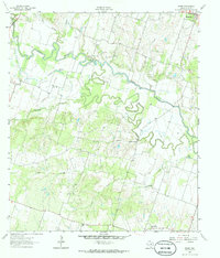
1963 Map of Sharp
USGS Topo · Published 1986About this map
Little River meanders across this Central Texas landscape, creating a complex hydrologic network of oxbows and cutoffs. The river's influence is clear in features like Mumford Lake and the Little River Cutoff, while historical transit points such as Bryant Station Bridge and Cummins Crossing highlight the era's reliance on specific river fords. Small rural communities like Buckholts, Val Verde, and Sanpier serve as local anchors, each connected by a web of unimproved roads and fine red dashed lines indicating property fence lines.
Find a feature on this map
31 named features on this map. Tap any name to fly to it.
Don’t see what you’re looking for? This feature index may not catch every label — zoom into the map to look around manually.
Map Details
Editions of this 1963 Sharp Map
3 editions found
Other maps of this area

1885 · Taylor
USGS Topo · 1:125,000

1887 · Taylor
USGS Topo · 1:125,000

1894 · Taylor
USGS Topo · 1:125,000

1910 · Buckholts
USGS Topo · 1:24,000

1912 · Buckholts
USGS Topo · 1:31,680

1954 · Austin
USGS Topo · 1:250,000

1962 · Rockdale West
USGS Topo · 1:24,000
1962 · Pettibone
USGS Topo · 1:24,000
1963 · Sharp
USGS Topo · 1:24,000

1963 · Friendship
USGS Topo · 1:24,000