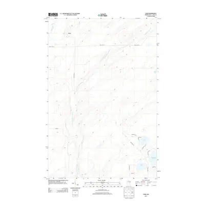
2013 Map of Shaw
USGS Topo · Published 2013About this map
The settlement of Shaw serves as a primary reference point in this portion of Saint Louis County, where the landscape is defined by the winding course of the Us-Kab-Wan-Ka River. To the southeast, the terrain transitions into a more water-dense region featuring Island Lake Reservoir, Cooks Lake, and Morgan Lake. The presence of several named roads, such as Munger Shaw Rd and Three Lakes Rd, indicates the established local transportation network connecting these rural townships. The northern reaches are drained by Bug Creek, while the eastern edge includes Nevens Lake. This area reflects the typical geography of northeastern Minnesota, characterized by glacial lake formations and river systems that have historically supported the regional timber and recreation economies.
Find a feature on this map
21 named features on this map. Tap any name to fly to it.
Don’t see what you’re looking for? This feature index may not catch every label — zoom into the map to look around manually.
Map Details
Editions of this 2013 Shaw Map
This is the sole edition of this map. No revisions or reprints were ever made.
Other maps of this area

1895 · Duluth
USGS Topo · 1:62,500

1953 · Twig
USGS Topo · 1:24,000

1953 · Canyon
USGS Topo · 1:24,000

1953 · Shaw
USGS Topo · 1:24,000

1953 · Boulder Lake Reservoir
USGS Topo · 1:24,000

1953 · Fredenberg
USGS Topo · 1:24,000

1953 · Independence
USGS Topo · 1:24,000

1953 · Duluth
USGS Topo · 1:62,500

1953 · Duluth
USGS Topo · 1:250,000

1954 · Hibbing
USGS Topo · 1:250,000