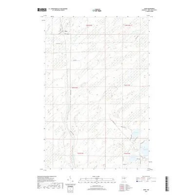
2019 Map of Shaw
USGS Topo · Published 2019About this map
The small settlement of Shaw sits in the northern reaches of this Saint Louis County landscape, a region defined by its expansive wetlands and winding water systems. The Us-Kab-Wan-Ka River meanders south through the center of the quadrangle, eventually meeting the northern edge of the Island Lake Reservoir. This map reflects the modern rural infrastructure of the area, where historical property lines and township divisions are traversed by local routes such as Munger Shaw Rd and Co Hwy 15. To the southeast, the terrain shifts toward more concentrated water bodies, including Morgan Lake and Cooks Lake, surrounded by a network of smaller residential roads like Skogvei Rd and Cook Lake Dr. The drainage patterns of Bug Creek in the northwest further illustrate the low-lying, water-dominant nature of this northern Minnesota territory.
Find a feature on this map
29 named features on this map. Tap any name to fly to it.
Don’t see what you’re looking for? This feature index may not catch every label — zoom into the map to look around manually.
Map Details
Editions of this 2019 Shaw Map
This is the sole edition of this map. No revisions or reprints were ever made.
Other maps of this area

1895 · Duluth
USGS Topo · 1:62,500

1953 · Twig
USGS Topo · 1:24,000

1953 · Canyon
USGS Topo · 1:24,000

1953 · Shaw
USGS Topo · 1:24,000

1953 · Boulder Lake Reservoir
USGS Topo · 1:24,000

1953 · Fredenberg
USGS Topo · 1:24,000

1953 · Independence
USGS Topo · 1:24,000

1953 · Duluth
USGS Topo · 1:62,500

1953 · Duluth
USGS Topo · 1:250,000

1954 · Hibbing
USGS Topo · 1:250,000