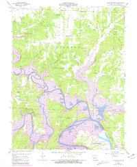
1959 Map of Shawnee Bend
USGS Topo · Published 1981About this map
Warsaw stands at a pivotal river junction where the Osage River, Grand River, and South River converge, a geography transformed by the mid-century development of the Harry S Truman Reservoir. This 1959 survey, updated in the early 1980s, documents the complex shoreline of the Lake-of-the-Ozarks and the surrounding wildlife management areas. The map details a rural landscape transitioning into a major recreational hub, preserving the locations of early 20th-century community centers like Racket, the Sunnyside School, and the Shady Grove Church.
Find a feature on this map
43 named features on this map. Tap any name to fly to it.
Don’t see what you’re looking for? This feature index may not catch every label — zoom into the map to look around manually.
Map Details
Editions of this 1959 Shawnee Bend Map
3 editions found
Other maps of this area

1887 · Clinton
USGS Topo · 1:125,000

1887 · Warsaw
USGS Topo · 1:125,000

1894 · Warsaw
USGS Topo · 1:125,000

1894 · Clinton
USGS Topo · 1:125,000

1935 · Dell
USGS Topo · 1:24,000

1936 · Shawnee Bend
USGS Topo · 1:24,000

1936 · Schuyler
USGS Topo · 1:24,000

1941 · Valhalla
USGS Topo · 1:24,000

1945 · Fristoe
USGS Topo · 1:62,500
1945 · Valhalla
USGS Topo · 1:24,000