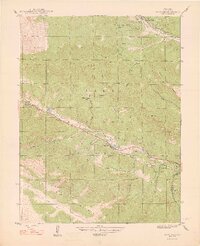
1948 Map of Shawnee
USGS Topo · Published 1948About this map
The North Fork South Platte River carves a central corridor through this 1940s landscape, serving as the primary anchor for local transportation and settlement. The small communities of Shawnee and Glenisle are situated along its banks, connected by the winding path of route 285. The map reveals a mountain economy transitioning from early ranching toward recreational and institutional land use, evidenced by the presence of the Willow Creek Ranch and the Case School near the river fork.
Find a feature on this map
30 named features on this map. Tap any name to fly to it.
Don’t see what you’re looking for? This feature index may not catch every label — zoom into the map to look around manually.
Map Details
Editions of this 1948 Shawnee Map
2 editions found
Other maps of this area

1893 · Platte Canyon
USGS Topo · 1:125,000

1899 · West Denver
USGS Topo · 1:125,000

1903 · Georgetown
USGS Topo · 1:62,500

1905 · Georgetown
USGS Topo · 1:62,500

1945 · Bailey
USGS Topo · 1:24,000

1945 · Shawnee
USGS Topo · 1:24,000

1945 · Mount Logan
USGS Topo · 1:24,000

1948 · Mount Logan
USGS Topo · 1:24,000

1948 · Shawnee
USGS Topo · 1:24,000

1949 · Bailey
USGS Topo · 1:24,000