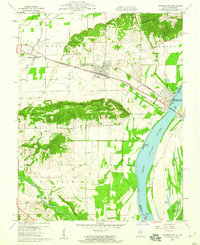
1959 Map of Shawneetown
USGS Topo · Published 1960About this map
The transition of a historic river landing is recorded here, where Old Shawneetown sits along the banks of the Ohio River while the newer settlement of Shawneetown has moved inland to higher ground. This shift, necessitated by the river's frequent flooding, is connected by the shared infrastructure of the Baltimore and Ohio and Louisville and Nashville railroads. The landscape is defined by the prominent ridge of Gold Hill and the Shawneetown Hills, which stand above the low-lying bottomlands and the winding Saline River.
Find a feature on this map
41 named features on this map. Tap any name to fly to it.
Don’t see what you’re looking for? This feature index may not catch every label — zoom into the map to look around manually.
Map Details
Editions of this 1959 Shawneetown Map
3 editions found
Other maps of this area

1905 · Eldorado
USGS Topo · 1:62,500

1905 · New Haven
USGS Topo · 1:62,500

1906 · New Haven
USGS Topo · 1:62,500

1906 · Eldorado
USGS Topo · 1:62,500

1916 · Shawneetown
USGS Topo · 1:62,500

1916 · Equality
USGS Topo · 1:62,500

1949 · Paducah
USGS Topo · 1:250,000

1949 · New Haven
USGS Topo · 1:62,500

1950 · Paducah
USGS Topo · 1:250,000
1953 · Wabash Island
USGS Topo · 1:24,000