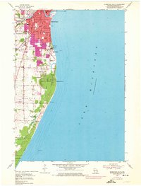
1954 Map of Sheboygan South
USGS Topo · Published 1974About this map
Industrial infrastructure and shoreline preservation define this mid-century view of southern Sheboygan. The Chicago and North Western railway corridors anchor the urban grid, serving sites like the Refinery and a Gravel Pit near Kohler. Along the coast of Lake Michigan, the Edgewater Powerplant and a Sewage Disposal facility sit north of the developing suburbs, while further south, the landscape transitions to the protected dunes of Terry Andrae State Park.
Find a feature on this map
39 named features on this map. Tap any name to fly to it.
Don’t see what you’re looking for? This feature index may not catch every label — zoom into the map to look around manually.
Map Details
Editions of this 1954 Sheboygan South Map
3 editions found
Other maps of this area

1954 · Sheboygan Falls
USGS Topo · 1:62,500

1954 · Sheboygan South
USGS Topo · 1:62,500

1954 · Sheboygan Falls
USGS Topo · 1:24,000

1954 · Sheboygan North
USGS Topo · 1:62,500

1954 · Sheboygan North
USGS Topo · 1:24,000

1954 · Sheboygan South
USGS Topo · 1:24,000

1954 · Howards Grove
USGS Topo · 1:62,500

1954 · Howards Grove
USGS Topo · 1:24,000

1954 · Milwaukee
USGS Topo · 1:250,000

1958 · Milwaukee
USGS Topo · 1:250,000