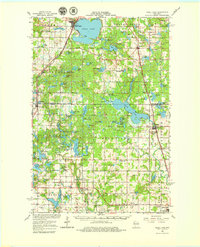
1965 Map of Shell Lake
USGS Topo · Published 1979About this map
The city of Shell Lake and its surrounding glacial landscape define this mid-1960s survey of northwestern Wisconsin. The Chicago and North Western railroad provides a central transportation spine, connecting the settlements of Barronett, Shell Lake, Sarona, and Haugen. The region is marked by an extensive network of water bodies, from the prominent Bear Lake and Little Ripley Lake to the more secluded Shingle Camp Lake and Kekegama Lake.
Find a feature on this map
115 named features on this map. Tap any name to fly to it.
Don’t see what you’re looking for? This feature index may not catch every label — zoom into the map to look around manually.
Map Details
Editions of this 1965 Shell Lake Map
2 editions found

Other maps of this area

1948 · Spooner
USGS Topo · 1:48,000

1948 · Stone Lake
USGS Topo · 1:48,000

1949 · Hertel
USGS Topo · 1:48,000

1949 · Spooner
USGS Topo · 1:48,000

1949 · Rice Lake
USGS Topo · 1:48,000

1950 · Stone Lake
USGS Topo · 1:48,000

1950 · Turtle Lake
USGS Topo · 1:62,500

1951 · Cumberland
USGS Topo · 1:48,000

1951 · Shell Lake
USGS Topo · 1:48,000

1951 · Rice Lake
USGS Topo · 1:48,000