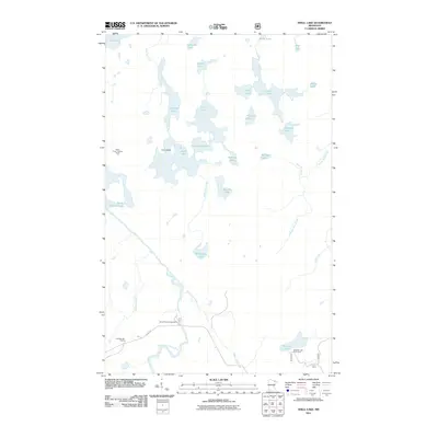
2011 Map of Shell Lake
USGS Topo · Published 2011About this map
Shell Lake and its surrounding boreal landscape define this portion of the northern Minnesota wilderness as it appeared in the early 21st century. The map reveals a complex aquatic network where the Little Indian Sioux River meanders through the southern half, fed by numerous tributaries such as Heritage Creek and Range Line Creek. The presence of the Sioux River Lookout Tower in the west and the Echo Trl in the southwest suggests the dual role of the region as both a protected natural resource and a recreational destination.
Find a feature on this map
34 named features on this map. Tap any name to fly to it.
Don’t see what you’re looking for? This feature index may not catch every label — zoom into the map to look around manually.
Map Details
Editions of this 2011 Shell Lake Map
This is the sole edition of this map. No revisions or reprints were ever made.
Other maps of this area

1954 · International Falls
USGS Topo · 1:250,000

1957 · International Falls
USGS Topo · 1:250,000

1958 · International Falls
USGS Topo · 1:250,000
1963 · Coleman Island
USGS Topo · 1:24,000

1963 · Takucmich Lake
USGS Topo · 1:24,000

1963 · Snow Bay
USGS Topo · 1:24,000

1963 · Astrid Lake
USGS Topo · 1:24,000

1963 · Lake Jeanette
USGS Topo · 1:24,000
1963 · Lapond Lake
USGS Topo · 1:24,000
1963 · Shell Lake
USGS Topo · 1:24,000