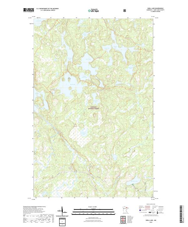
2022 Map of Shell Lake
USGS Topo · Published 2022About this map
Superior National Forest encompasses this wilderness region of northern St. Louis County, where an intricate network of portages and hiking paths connects dozens of isolated water bodies. The Sioux Hustler Trl and various spur trails like the Shell-Pauness Trl navigate the land between Shell Lake and Hustler Lake, providing access to the interior landscape. The Little Indian Sioux River flows through the western portion of the quadrangle, notably passing through the Devils Cascade as it moves toward the international border. In the southern reach, the Echo Trail and Meander Lake Rd offer the primary vehicular access points into this lake-dominated terrain. From the centrally located Con Island in Shell Lake to the remote reaches of Woksapiwi Lake and Emerald Lake, the map documents a geography defined by post-glacial hydrology and established forest management.
Find a feature on this map
44 named features on this map. Tap any name to fly to it.
Don’t see what you’re looking for? This feature index may not catch every label — zoom into the map to look around manually.
Map Details
Editions of this 2022 Shell Lake Map
This is the sole edition of this map. No revisions or reprints were ever made.
Other maps of this area

1954 · International Falls
USGS Topo · 1:250,000

1957 · International Falls
USGS Topo · 1:250,000

1958 · International Falls
USGS Topo · 1:250,000
1963 · Coleman Island
USGS Topo · 1:24,000

1963 · Takucmich Lake
USGS Topo · 1:24,000

1963 · Snow Bay
USGS Topo · 1:24,000

1963 · Astrid Lake
USGS Topo · 1:24,000

1963 · Lake Jeanette
USGS Topo · 1:24,000
1963 · Lapond Lake
USGS Topo · 1:24,000
1963 · Shell Lake
USGS Topo · 1:24,000