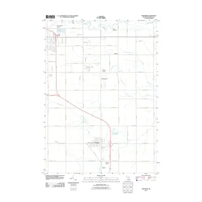
2011 Map of Shepherd
USGS Topo · Published 2011About this map
The village of Shepherd and the surrounding township lands of southern Isabella County are defined here by a network of agricultural roads and winding waterways. The northern reach of the map is dominated by the Chippewa River, while Salt Creek and Potter Creek drain the central and southern plains. This 2011 survey captures the transition of historical rural landmarks into the modern era, notably preserving the location of the Isabella County Poor Farm Cemetery alongside the Chippewa Township Cemetery. To the northwest, the landscape reflects development around the Mount Pleasant Municipal Airport and recreational sites like the Pohlcat Golf Course. The small settlement of Alembic remains visible as a crossroads community, while the primary activity centers on the village core near the Shepherd Post Office. Large cemeteries such as Salt River Cemetery and Saint Vincent de Paul Cemetery provide essential reference points for local family history research in this part of Michigan.
Find a feature on this map
51 named features on this map. Tap any name to fly to it.
Don’t see what you’re looking for? This feature index may not catch every label — zoom into the map to look around manually.
Map Details
Editions of this 2011 Shepherd Map
This is the sole edition of this map. No revisions or reprints were ever made.
Other maps of this area

1916 · Mount Pleasant
USGS Topo · 1:62,500

1919 · Mount Pleasant
USGS Topo · 1:62,500

1930 · Shepherd
USGS Topo · 1:48,000

1935 · Alma
USGS Topo · 1:62,500

1936 · Shepherd
USGS Topo · 1:62,500

1938 · Alma
USGS Topo · 1:62,500

1943 · Mount Pleasant
USGS Topo · 1:62,500

1954 · Midland
USGS Topo · 1:250,000

1958 · Midland
USGS Topo · 1:250,000

1959 · Midland
USGS Topo · 1:250,000