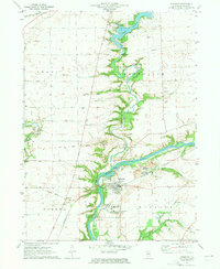
1971 Map of Sheridan
USGS Topo · Published 1973About this map
The Fox River carves through this LaSalle County landscape, anchoring the settlement of Sheridan and serving as a focal point for local industry. Large-scale extractive operations including several Quarries and numerous Gravel Pits line the riverbanks and the course of Somonauk Creek, which flows south into the Fox through a series of dramatic bends. To the north, Holiday Lake and the residential area of Northville illustrate the mid-century development of the region, while the Illinois Industrial School For Boys stands as a significant institutional landmark south of the main town.
Find a feature on this map
34 named features on this map. Tap any name to fly to it.
Don’t see what you’re looking for? This feature index may not catch every label — zoom into the map to look around manually.
Map Details
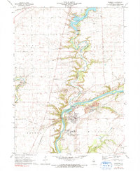
Editions of this 1971 Sheridan Map
2 editions found
Other maps of this area

1892 · Marseilles
USGS Topo · 1:62,500

1892 · Ottawa
USGS Topo · 1:62,500

1915 · Ottawa
USGS Topo · 1:62,500

1916 · Marseilles
USGS Topo · 1:62,500

1940 · Marseilles
USGS Topo · 1:62,500

1946 · Ottawa
USGS Topo · 1:62,500

1948 · Sandwich
USGS Topo · 1:62,500

1950 · Sandwich
USGS Topo · 1:62,500

1951 · Earlville
USGS Topo · 1:62,500

1958 · Aurora
USGS Topo · 1:250,000