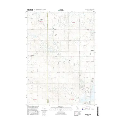
2017 Map of Sherman City
USGS Topo · Published 2017About this map
Sherman City sits at the northern edge of this landscape, marking a historical crossroad where the Mecosta Co Isabella Co boundary divides the terrain. The 2017 survey illustrates a region defined by its glacial hydrology, with the Chippewa River winding southward through a network of smaller bodies including Strong Lake, Hoffman Lake, and Round Lake. In the southeastern corner, the residential development around Lake Isabella stands in contrast to the more traditional grid-iron agricultural layouts found near settlements like Horr and Drew.
Find a feature on this map
73 named features on this map. Tap any name to fly to it.
Don’t see what you’re looking for? This feature index may not catch every label — zoom into the map to look around manually.
Map Details
Editions of this 2017 Sherman City Map
This is the sole edition of this map. No revisions or reprints were ever made.
Other maps of this area

1916 · Mount Pleasant
USGS Topo · 1:62,500

1919 · Mount Pleasant
USGS Topo · 1:62,500

1943 · Mount Pleasant
USGS Topo · 1:62,500

1954 · Midland
USGS Topo · 1:250,000

1958 · Midland
USGS Topo · 1:250,000

1959 · Midland
USGS Topo · 1:250,000

1959 · Lake
USGS Topo · 1:62,500

1959 · Clare
USGS Topo · 1:62,500

1964 · Mecosta NW
USGS Topo · 1:24,000

1964 · Blanchard
USGS Topo · 1:24,000