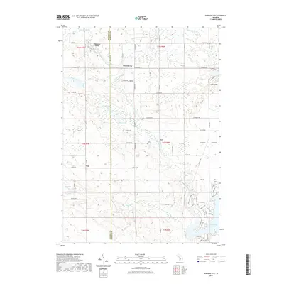
2019 Map of Sherman City
USGS Topo · Published 2019About this map
Sherman City and the surrounding borderlands of Mecosta and Isabella counties reveal a landscape defined by glacial lakes and the winding course of the Chippewa River. Small settlements such as Horr, Titus, and Drew are scattered throughout the region, often positioned at rural intersections that reflect the area's agricultural and logging heritage. Significant for genealogists, the map identifies local burial grounds including Sherman City Cem, Forest Hill Cem, and Strong Cem, which serve as quiet markers of the community's early residents. To the southeast, the residential development surrounding Lake Isabella shows a more modern shift in land use, featuring a dense network of streets like El Camino Grande and Castile Ln. The presence of the Ojibwa Airpark and numerous water bodies like Thompson Lake and Round Lake highlights the region's character as a destination for both aviation and outdoor recreation.
Find a feature on this map
70 named features on this map. Tap any name to fly to it.
Don’t see what you’re looking for? This feature index may not catch every label — zoom into the map to look around manually.
Map Details
Editions of this 2019 Sherman City Map
This is the sole edition of this map. No revisions or reprints were ever made.
Other maps of this area

1916 · Mount Pleasant
USGS Topo · 1:62,500

1919 · Mount Pleasant
USGS Topo · 1:62,500

1943 · Mount Pleasant
USGS Topo · 1:62,500

1954 · Midland
USGS Topo · 1:250,000

1958 · Midland
USGS Topo · 1:250,000

1959 · Midland
USGS Topo · 1:250,000

1959 · Lake
USGS Topo · 1:62,500

1959 · Clare
USGS Topo · 1:62,500

1964 · Mecosta NW
USGS Topo · 1:24,000

1964 · Blanchard
USGS Topo · 1:24,000