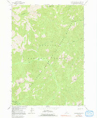
1963 Map of Sherman Peak
USGS Topo · Published 1991About this map
Sherman Peak and Mayfield Peak dominate this high-elevation landscape within the Challis National Forest. This 1963 field-checked survey documents a region defined by its complex drainage systems, including the headwaters of Mayfield Creek and its East Fork. The interior is characterized by the expansive Frank Church Return River of No Return Wilderness, a protected area where human development is absent, replaced by a dense network of watercourses like Wickiup Creek and Cottonwood Creek.
Find a feature on this map
19 named features on this map. Tap any name to fly to it.
Don’t see what you’re looking for? This feature index may not catch every label — zoom into the map to look around manually.
Map Details
Editions of this 1963 Sherman Peak Map
3 editions found
Other maps of this area

1919 · Custer
USGS Topo · 1:125,000

1922 · Custer
USGS Topo · 1:125,000

1930 · Casto
USGS Topo · 1:125,000

1957 · Challis
USGS Topo · 1:250,000

1960 · Challis
USGS Topo · 1:250,000

1963 · Challis
USGS Topo · 1:250,000

1963 · Challis Creek Lakes
USGS Topo · 1:24,000

1963 · Custer
USGS Topo · 1:24,000

1963 · Casto
USGS Topo · 1:24,000

1963 · Rock Creek
USGS Topo · 1:24,000