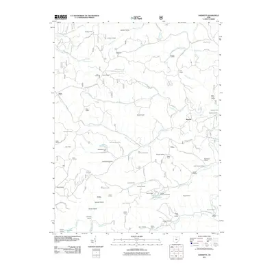
2011 Map of Sherritts
USGS Topo · Published 2011About this map
Sherritts serves as a quiet focal point in this portion of Lawrence County, where the landscape is defined by an intricate network of narrow valleys and named ridges. The map reveals a high density of family and community burial sites, such as the Joe Delawder Cemetery, Macedonia Cemetery, and Robinson Cemetery, which are scattered throughout the hollows. These features, along with the Slab Fork Church, point to a deeply rooted rural community structure.
Find a feature on this map
90 named features on this map. Tap any name to fly to it.
Don’t see what you’re looking for? This feature index may not catch every label — zoom into the map to look around manually.
Map Details
Editions of this 2011 Sherritts Map
This is the sole edition of this map. No revisions or reprints were ever made.
Other maps of this area

1898 · Ironton
USGS Topo · 1:62,500

1900 · Ironton
USGS Topo · 1:62,500

1906 · Bidwell
USGS Topo · 1:62,500

1906 · Athalia
USGS Topo · 1:62,500

1908 · Bidwell
USGS Topo · 1:62,500

1908 · Athalia
USGS Topo · 1:62,500

1912 · Oak Hill
USGS Topo · 1:62,500
1953 · Ironton
USGS Topo · 1:24,000

1957 · Huntington
USGS Topo · 1:250,000
1958 · Ironton
USGS Topo · 1:24,000