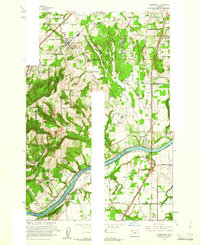
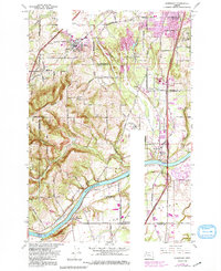
1961 Map of Sherwood
USGS Topo · Published 1961About this map
Sherwood and Wilsonville stand as central hubs in this early 1960s landscape, where the agricultural traditions of French Prairie meet the emerging modern infrastructure of the Baldock Freeway. The region is defined by its complex transportation network, featuring the Southern Pacific and Oregon Electric railroads alongside historic routes like Boones Ferry Road. Significant landmarks such as the Dammasch State Hospital and the industrial activity near Onion Flat contrast with the rural character of settlements like Butteville and Six Corners.
Find a feature on this map
53 named features on this map. Tap any name to fly to it.
Don’t see what you’re looking for? This feature index may not catch every label — zoom into the map to look around manually.
Map Details
Editions of this 1961 Sherwood Map
5 editions found
Other maps of this area

1914 · Oregon City
USGS Topo · 1:62,500

1916 · Tualatin
USGS Topo · 1:62,500

1923 · Mount Angel
USGS Topo · 1:62,500

1939 · Molalla
USGS Topo · 1:62,500

1939 · Oregon City
USGS Topo · 1:62,500

1939 · Tualatin
USGS Topo · 1:62,500

1940 · Tualatin
USGS Topo · 1:62,500

1940 · Molalla
USGS Topo · 1:62,500

1940 · Mount Angel
USGS Topo · 1:62,500

1941 · Oregon City
USGS Topo · 1:62,500