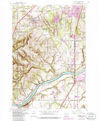
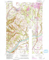
1961 Map of Sherwood
USGS Topo · Published 1985About this map
Sherwood and its surrounding agricultural landscape are captured here in the early 1960s, prior to the significant suburban expansion that would later redefine this portion of the Willamette Valley. The geography is defined by the sharp bend of the Willamette River and the fertile expanses of French Prairie to the south. Transportation corridors like the Southern Pacific railroad and the Baldock Freeway provide the primary north-south framework for the region.
Find a feature on this map
40 named features on this map. Tap any name to fly to it.
Don’t see what you’re looking for? This feature index may not catch every label — zoom into the map to look around manually.
Map Details
Editions of this 1961 Sherwood Map
5 editions found
Other maps of this area

1914 · Oregon City
USGS Topo · 1:62,500

1916 · Tualatin
USGS Topo · 1:62,500

1923 · Mount Angel
USGS Topo · 1:62,500

1939 · Molalla
USGS Topo · 1:62,500

1939 · Oregon City
USGS Topo · 1:62,500

1939 · Tualatin
USGS Topo · 1:62,500

1940 · Tualatin
USGS Topo · 1:62,500

1940 · Molalla
USGS Topo · 1:62,500

1940 · Mount Angel
USGS Topo · 1:62,500

1941 · Oregon City
USGS Topo · 1:62,500