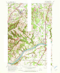
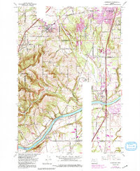
1961 Map of Sherwood
USGS Topo · Published 1971About this map
The Willamette River carves a deep path through this mid-century landscape, serving as a natural boundary between Clackamas and Marion counties. The river valley is flanked by significant rises like Ladd Hill and La Butte, while the northern portion of the map shows the emerging suburban and agricultural centers of Sherwood and Tualatin. Transport and institutional growth define the era, with the sprawling grounds of the Dammasch State Hospital and the intersecting routes of the Southern Pacific and Oregon Electric railroads.
Find a feature on this map
58 named features on this map. Tap any name to fly to it.
Don’t see what you’re looking for? This feature index may not catch every label — zoom into the map to look around manually.
Map Details
Editions of this 1961 Sherwood Map
5 editions found
Other maps of this area

1914 · Oregon City
USGS Topo · 1:62,500

1916 · Tualatin
USGS Topo · 1:62,500

1923 · Mount Angel
USGS Topo · 1:62,500

1939 · Molalla
USGS Topo · 1:62,500

1939 · Oregon City
USGS Topo · 1:62,500

1939 · Tualatin
USGS Topo · 1:62,500

1940 · Tualatin
USGS Topo · 1:62,500

1940 · Molalla
USGS Topo · 1:62,500

1940 · Mount Angel
USGS Topo · 1:62,500

1941 · Oregon City
USGS Topo · 1:62,500