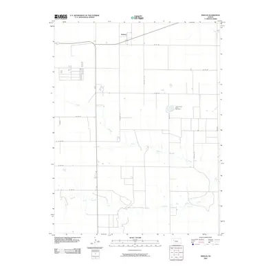
2009 Map of Shields
USGS Topo · Published 2009About this map
Shields serves as the primary settlement hub for this High Plains landscape in Lane County, defined by the intricate hydrological system of the Walnut Creek drainage. The map documents the branching forks that feed the basin, including the North Fork Walnut Creek and Middle Fork Walnut Creek, which carve subtle drainage patterns through the agricultural grid. A notable engineering and recreational feature is the Lane County State Lake Dam, situated east of the central corridor. The area is surveyed with a precise network of rural routes, often bearing evocative regional names like Longhorn Rd, Mustang Rd, and Ogallalah Rd. These roadways provide access to the dispersed farmsteads and agricultural operations that characterize this portion of western Kansas, reflecting a landscape where water management and transportation are essential to the local economy and community structure.
Find a feature on this map
18 named features on this map. Tap any name to fly to it.
Don’t see what you’re looking for? This feature index may not catch every label — zoom into the map to look around manually.
Map Details
Editions of this 2009 Shields Map
This is the sole edition of this map. No revisions or reprints were ever made.
Other maps of this area

1955 · Scott City
USGS Topo · 1:250,000

1958 · Scott City
USGS Topo · 1:250,000

1974 · Cheyenne Creek
USGS Topo · 1:24,000

1974 · Dighton
USGS Topo · 1:24,000

1974 · Alamota
USGS Topo · 1:24,000

1974 · Amy
USGS Topo · 1:24,000

1974 · Shields NW
USGS Topo · 1:24,000

1974 · Pendennis
USGS Topo · 1:24,000

1974 · Healy
USGS Topo · 1:24,000

1974 · Shields SE
USGS Topo · 1:24,000