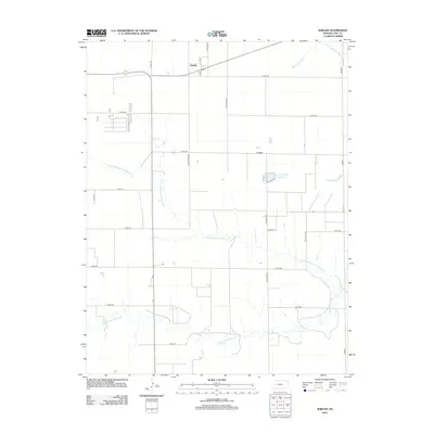
2012 Map of Shields
USGS Topo · Published 2012About this map
Shields sits at the northern edge of this Lane County landscape, where the high plains are dissected by a complex network of prairie streams. The drainage pattern is dominated by the westward-reaching branches of the Walnut Creek system, including the N Fork Walnut Cr, the winding Middle Fork Walnut Cr, and the extensive N Fork Middle Fork Walnut Cr. This 2012 survey reveals a classic section-line road grid that defines the agricultural character of the region, punctuated by localized water resources like Lane County State Lake and the drainage of Cottonwood Cr. The map illustrates the sparse but deliberate settlement pattern typical of western Kansas, where transportation routes like Co RD-240 and N Karl Rd link isolated homesteads to the central community hub.
Find a feature on this map
24 named features on this map. Tap any name to fly to it.
Don’t see what you’re looking for? This feature index may not catch every label — zoom into the map to look around manually.
Map Details
Editions of this 2012 Shields Map
This is the sole edition of this map. No revisions or reprints were ever made.
Other maps of this area

1955 · Scott City
USGS Topo · 1:250,000

1958 · Scott City
USGS Topo · 1:250,000

1974 · Cheyenne Creek
USGS Topo · 1:24,000

1974 · Dighton
USGS Topo · 1:24,000

1974 · Alamota
USGS Topo · 1:24,000

1974 · Amy
USGS Topo · 1:24,000

1974 · Shields NW
USGS Topo · 1:24,000

1974 · Pendennis
USGS Topo · 1:24,000

1974 · Healy
USGS Topo · 1:24,000

1974 · Shields SE
USGS Topo · 1:24,000