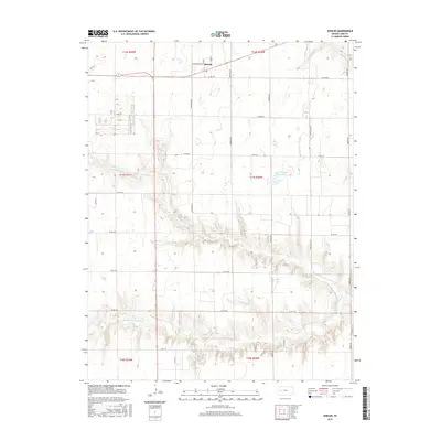
2015 Map of Shields
USGS Topo · Published 2015About this map
Shields is the primary settlement in this section of Lane County, centered on W Washington St and Elm street. The landscape is defined by the drainage network of the Walnut Creek system, which carves deep, complex coulees and draws through the High Plains. These hydrological features include the N Fork Walnut Cr in the northeast and the Middle Fork Walnut Cr across the southern half, often accompanied by local wetlands. The transition from flat agricultural tablelands into these rugged drainage basins is starkly visible through the contour lines. Lane County State Lake provides a distinct landmark east of the main north-south artery, N Hwy 23. A grid of section-line roads, such as Ogallalah Rd and Co Rd 200, overlays the terrain, facilitating access to the various townships within T16S, T17S, and T18S.
Find a feature on this map
29 named features on this map. Tap any name to fly to it.
Don’t see what you’re looking for? This feature index may not catch every label — zoom into the map to look around manually.
Map Details
Editions of this 2015 Shields Map
This is the sole edition of this map. No revisions or reprints were ever made.
Other maps of this area

1955 · Scott City
USGS Topo · 1:250,000

1958 · Scott City
USGS Topo · 1:250,000

1974 · Cheyenne Creek
USGS Topo · 1:24,000

1974 · Dighton
USGS Topo · 1:24,000

1974 · Alamota
USGS Topo · 1:24,000

1974 · Amy
USGS Topo · 1:24,000

1974 · Shields NW
USGS Topo · 1:24,000

1974 · Pendennis
USGS Topo · 1:24,000

1974 · Healy
USGS Topo · 1:24,000

1974 · Shields SE
USGS Topo · 1:24,000