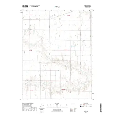
2018 Map of Shields
USGS Topo · Published 2018About this map
Shields serves as the primary settlement on this High Plains landscape, situated along the northern edge where the open terrain begins to break into the complex drainage systems of the Walnut Creek watershed. The geography is defined by a series of branching waterways, including N Fork Walnut Cr and Middle Fork Walnut Cr, which carve deep, winding coulees through the flat plains. These topographic shifts are most dramatic as the land descends toward Lane County State Lake, a notable local landmark and water resource. The survey illustrates a rigid grid of county roads, such as Longhorn Rd and Mustang Rd, which navigate the elevation changes created by the N Fork Middle Fork Walnut Cr. This network provides a clear view of land division and rural infrastructure in Lane County during the early twenty-first century.
Find a feature on this map
25 named features on this map. Tap any name to fly to it.
Don’t see what you’re looking for? This feature index may not catch every label — zoom into the map to look around manually.
Map Details
Editions of this 2018 Shields Map
This is the sole edition of this map. No revisions or reprints were ever made.
Other maps of this area

1955 · Scott City
USGS Topo · 1:250,000

1958 · Scott City
USGS Topo · 1:250,000

1974 · Cheyenne Creek
USGS Topo · 1:24,000

1974 · Dighton
USGS Topo · 1:24,000

1974 · Alamota
USGS Topo · 1:24,000

1974 · Amy
USGS Topo · 1:24,000

1974 · Shields NW
USGS Topo · 1:24,000

1974 · Pendennis
USGS Topo · 1:24,000

1974 · Healy
USGS Topo · 1:24,000

1974 · Shields SE
USGS Topo · 1:24,000