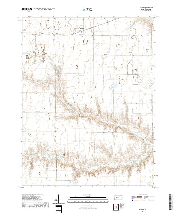
2022 Map of Shields
USGS Topo · Published 2022About this map
The small community of Shields serves as the primary focal point of this western Kansas landscape, situated where W Washington St and Laredo meet. This survey reveals a terrain defined by the dendritic drainage patterns of the Walnut Creek system, specifically the N Fork Walnut Cr and Middle Fork Walnut Cr. The land is organized into a rigid grid of rural thoroughfares, such as Ogallalah Rd and Newton Rd, which cut across the High Plains topography. The transition from the flat tablelands to the deeply incised valleys of the N Fork Middle Fork Walnut Cr highlights the erosion-carved geography typical of Lane County, providing a clear view of how early homestead boundaries and later county roads were established in relation to these natural watercourses.
Find a feature on this map
29 named features on this map. Tap any name to fly to it.
Don’t see what you’re looking for? This feature index may not catch every label — zoom into the map to look around manually.
Map Details
Editions of this 2022 Shields Map
This is the sole edition of this map. No revisions or reprints were ever made.
Other maps of this area

1955 · Scott City
USGS Topo · 1:250,000

1958 · Scott City
USGS Topo · 1:250,000

1974 · Cheyenne Creek
USGS Topo · 1:24,000

1974 · Dighton
USGS Topo · 1:24,000

1974 · Alamota
USGS Topo · 1:24,000

1974 · Amy
USGS Topo · 1:24,000

1974 · Shields NW
USGS Topo · 1:24,000

1974 · Pendennis
USGS Topo · 1:24,000

1974 · Healy
USGS Topo · 1:24,000

1974 · Shields SE
USGS Topo · 1:24,000