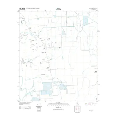
2013 Map of Shiloh
USGS Topo · Published 2013About this map
Shiloh and the Abshier Settlement anchor this portrait of Liberty County, where a complex network of bayous and drainage canals defines the coastal prairie. The landscape is heavily marked by local family heritage, evidenced by more than ten distinct burial grounds including Lone Star Cem, Quarters Cem, and the uniquely named Pignut Gully Cem. Water management is central to the area's geography, with the W Br Devers Canal cutting across the northern reaches and Turtle Bayou meandering toward the southern marshes. Near the western edge, Swinney Marsh and the Trinity River's Fisher Bend highlight the transition into the river bottomlands. This 2013 survey provides a clear look at the distribution of small settlements like Tivett and the agricultural infrastructure surrounding Lake Charlotte.
Find a feature on this map
71 named features on this map. Tap any name to fly to it.
Don’t see what you’re looking for? This feature index may not catch every label — zoom into the map to look around manually.
Map Details
Editions of this 2013 Shiloh Map
This is the sole edition of this map. No revisions or reprints were ever made.
Other maps of this area

1942 · Anahuac
USGS Topo · 1:24,000

1943 · Whites Bayou
USGS Topo · 1:24,000

1943 · Liberty
USGS Topo · 1:125,000

1950 · Houston
USGS Topo · 1:250,000

1954 · Beaumont
USGS Topo · 1:250,000

1955 · Daisetta
USGS Topo · 1:62,500

1955 · Liberty
USGS Topo · 1:62,500

1956 · Houston
USGS Topo · 1:250,000

1957 · Beaumont
USGS Topo · 1:250,000
1961 · Anahuac
USGS Topo · 1:24,000