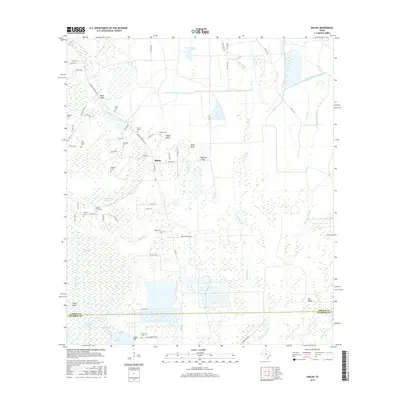
2016 Map of Shiloh
USGS Topo · Published 2016About this map
Lake Charlotte and the surrounding marshlands dominate the southern reach of this 2016 survey, where the Trinity River snakes along the western boundary near Fisher Bend. The settlement of Shiloh serves as a central point in a landscape defined by an extensive network of drainage gullies and irrigation infrastructure, including the West Branch Devers Canal and Black Gully.
Find a feature on this map
72 named features on this map. Tap any name to fly to it.
Don’t see what you’re looking for? This feature index may not catch every label — zoom into the map to look around manually.
Map Details
Editions of this 2016 Shiloh Map
This is the sole edition of this map. No revisions or reprints were ever made.
Other maps of this area

1942 · Anahuac
USGS Topo · 1:24,000

1943 · Whites Bayou
USGS Topo · 1:24,000

1943 · Liberty
USGS Topo · 1:125,000

1950 · Houston
USGS Topo · 1:250,000

1954 · Beaumont
USGS Topo · 1:250,000

1955 · Daisetta
USGS Topo · 1:62,500

1955 · Liberty
USGS Topo · 1:62,500

1956 · Houston
USGS Topo · 1:250,000

1957 · Beaumont
USGS Topo · 1:250,000
1961 · Anahuac
USGS Topo · 1:24,000