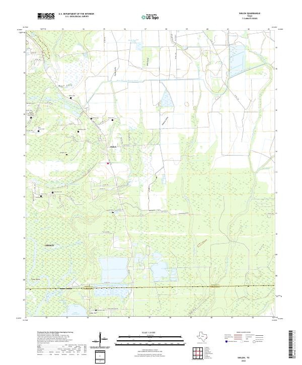
2022 Map of Shiloh
USGS Topo · Published 2022About this map
Shiloh and the southern reaches of Liberty County emerge from this 2022 survey as a landscape defined by its intricate water systems and numerous family burial grounds. The Trinity River winds along the western boundary, while the West Branch Devers Canal and a network of named gullies like Black Gully and Pignut Gully indicate a long history of water management for local agriculture. This area is particularly significant for genealogists, as it contains a remarkably high density of small cemeteries, including the Mount Zion Baptist Church Cem, Quarters Cem, and the Albritton Cem. To the south, the terrain transitions into the wetlands and bayous surrounding Lake Charlotte and Mac Lake, where Cedar Hill stands near the border of Chambers County. This detailed mapping of the Turtle Bayou and Cow Island Bayou systems reveals how the local geography has dictated the placement of rural roads and scattered homesteads across the Texas coastal plain.
Find a feature on this map
80 named features on this map. Tap any name to fly to it.
Don’t see what you’re looking for? This feature index may not catch every label — zoom into the map to look around manually.
Map Details
Editions of this 2022 Shiloh Map
This is the sole edition of this map. No revisions or reprints were ever made.
Other maps of this area

1942 · Anahuac
USGS Topo · 1:24,000

1943 · Whites Bayou
USGS Topo · 1:24,000

1943 · Liberty
USGS Topo · 1:125,000

1950 · Houston
USGS Topo · 1:250,000

1954 · Beaumont
USGS Topo · 1:250,000

1955 · Daisetta
USGS Topo · 1:62,500

1955 · Liberty
USGS Topo · 1:62,500

1956 · Houston
USGS Topo · 1:250,000

1957 · Beaumont
USGS Topo · 1:250,000
1961 · Anahuac
USGS Topo · 1:24,000