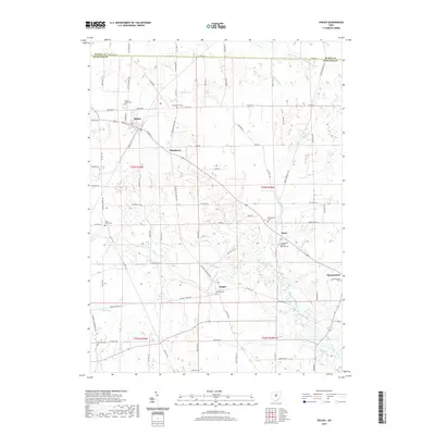
2019 Map of Shiloh
USGS Topo · Published 2019About this map
Shiloh anchors the northwestern corner of this landscape, where the street grid of Main St W and Superior St meets the rural agricultural expanse of northern Ohio. The map documents a cluster of traditional crossroads settlements, including Planktown, Rome, and Ganges, each defined by their historic cemeteries and proximity to local waterways. The hydrology of the region is notably complex, as the terrain divides between the northward-flowing Southwest Br Vermilion River and the southward-draining Black Fork Mohican River. Genealogists will find a high density of burial sites such as Mount Hope Cem and the Evangelical German Reform Cem, reflecting the early religious and community life of these townships. The survey highlights how the land has been organized by the sectional grid, with roads like Base Line Rd W and Rome Greenwich Rd serving as the primary arteries for this enduring farming region.
Find a feature on this map
86 named features on this map. Tap any name to fly to it.
Don’t see what you’re looking for? This feature index may not catch every label — zoom into the map to look around manually.
Map Details
Editions of this 2019 Shiloh Map
This is the sole edition of this map. No revisions or reprints were ever made.
Other maps of this area

1908 · Ashland
USGS Topo · 1:62,500

1908 · New London
USGS Topo · 1:62,500

1915 · Norwalk
USGS Topo · 1:62,500

1915 · Crestline
USGS Topo · 1:62,500

1943 · Crestline
USGS Topo · 1:62,500

1944 · Norwalk
USGS Topo · 1:62,500

1950 · Marion
USGS Topo · 1:250,000

1956 · Toledo
USGS Topo · 1:250,000

1960 · New London
USGS Topo · 1:24,000

1960 · Willard
USGS Topo · 1:24,000