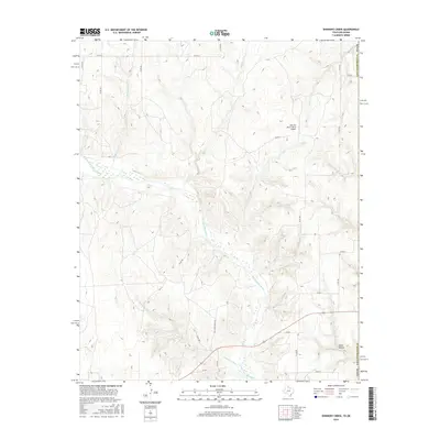
2016 Map of Shinnery Creek
USGS Topo · Published 2016About this map
The Salt Fork Red River meanders across this landscape in Harmon County, Oklahoma, defining the drainage patterns for several intermittent tributaries. This 2016 survey illustrates a largely rural and agricultural region where the terrain is marked by distinct features such as Dixon Hollow in the southeastern corner. The mapping of Mill Iron Ranch North Airport and Mill Iron Ranch Rd indicates the presence of larger ranching operations that have shaped the local economy and land use near the border of Collingsworth County, Texas.
Find a feature on this map
25 named features on this map. Tap any name to fly to it.
Don’t see what you’re looking for? This feature index may not catch every label — zoom into the map to look around manually.
Map Details
Editions of this 2016 Shinnery Creek Map
This is the sole edition of this map. No revisions or reprints were ever made.
Other maps of this area

1954 · Amarillo
USGS Topo · 1:250,000

1954 · Plainview
USGS Topo · 1:250,000

1955 · Lawton
USGS Topo · 1:250,000

1955 · Clinton
USGS Topo · 1:250,000

1957 · Clinton
USGS Topo · 1:250,000

1958 · Amarillo
USGS Topo · 1:250,000

1958 · Plainview
USGS Topo · 1:250,000

1959 · Wellington NW
USGS Topo · 1:24,000

1959 · Shinnery Creek
USGS Topo · 1:24,000

1961 · Erick
USGS Topo · 1:62,500