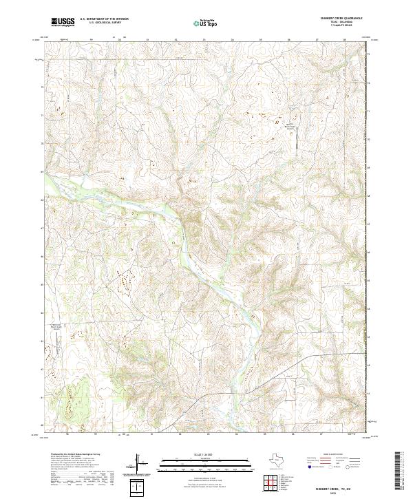
2022 Map of Shinnery Creek
USGS Topo · Published 2022About this map
Salt Fork Red River meanders across this Panhandle landscape, carving a wide alluvial valley through the high plains of Collingsworth Co. The drainage network is dense with named tributaries including Shinnery Cr, Roundup Cr, and Dry Cr, illustrating the complex hydrology of this arid region. The presence of both the Mill-Iron Ranch North Airport and the Mill Iron Ranch South Airport indicates the significant scale of local ranching operations, where aviation is an essential tool for managing remote acreage. A systematic grid of county roads, such as Co RD 230 and Co RD 295, partitions the terrain, while landmarks like Dixon Hollow provide historical reference points for local genealogists and researchers tracing rural Texas land use.
Find a feature on this map
29 named features on this map. Tap any name to fly to it.
Don’t see what you’re looking for? This feature index may not catch every label — zoom into the map to look around manually.
Map Details
Editions of this 2022 Shinnery Creek Map
This is the sole edition of this map. No revisions or reprints were ever made.
Other maps of this area

1954 · Amarillo
USGS Topo · 1:250,000

1954 · Plainview
USGS Topo · 1:250,000

1955 · Lawton
USGS Topo · 1:250,000

1955 · Clinton
USGS Topo · 1:250,000

1957 · Clinton
USGS Topo · 1:250,000

1958 · Amarillo
USGS Topo · 1:250,000

1958 · Plainview
USGS Topo · 1:250,000

1959 · Wellington NW
USGS Topo · 1:24,000

1959 · Shinnery Creek
USGS Topo · 1:24,000

1961 · Erick
USGS Topo · 1:62,500