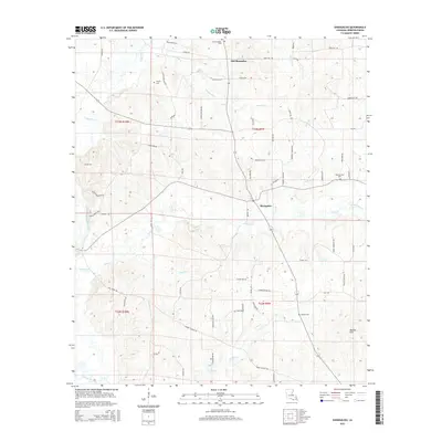
2015 Map of Shongaloo
USGS Topo · Published 2015About this map
Shongaloo and Old Shongaloo define this north Louisiana landscape, situated in a region defined by a dense network of small waterways and local cemeteries. The geography is dominated by numerous branches and creeks, including Cypress Cr, Leonard Br, and Indian Cr, which feed south toward Bayou Dorcheat. Local family history is well-preserved through several established burial grounds such as Old Shongallo Cem, Haynes Cem, Pilgrims Rest Cem, and Hudson Cem. The road network reflects a quiet agricultural and residential character, with family-named thoroughfares like Elton Wise Rd, Cowboy Morgan Rd, and Jewell Manning Rd connecting the scattered homesteads. Near the southern edge, Duncan Hill rises above the basin of Caney Cr, providing one of the few named topographic landmarks in this stretch of Webster Parish.
Find a feature on this map
70 named features on this map. Tap any name to fly to it.
Don’t see what you’re looking for? This feature index may not catch every label — zoom into the map to look around manually.
Map Details
Editions of this 2015 Shongaloo Map
This is the sole edition of this map. No revisions or reprints were ever made.
Other maps of this area

1922 · Sarepta
USGS Topo · 1:62,500

1924 · Sarepta
USGS Topo · 1:62,500

1952 · Homer
USGS Topo · 1:62,500

1953 · El Dorado
USGS Topo · 1:250,000

1955 · Shreveport
USGS Topo · 1:250,000

1956 · Shreveport
USGS Topo · 1:250,000

1956 · Sarepta
USGS Topo · 1:62,500

1957 · El Dorado
USGS Topo · 1:250,000

1958 · El Dorado
USGS Topo · 1:250,000

1960 · El Dorado
USGS Topo · 1:250,000