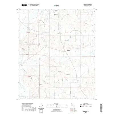
2020 Map of Shongaloo
USGS Topo · Published 2020About this map
Shongaloo and its historical counterpart Old Shongaloo anchor this northern Louisiana landscape, where the terrain is defined by a dense network of tributaries feeding into Bayou Dorcheat. The map documents a rural community deeply connected to its land through family-named roads and numerous burial grounds, such as Sikes Ferry Cem and the Hudson - Wortham Cem. The distribution of these sites, including the Union Springs Church Cem and Pilgrims Rest Cem, suggests a long-standing settlement pattern centered around small church congregations and family plots. To the southeast, Duncan Hill rises above the surrounding bottomlands of Caney Cr and Indian Cr. The presence of a Gravel Pit near John Pope Rd indicates the local industrial activity, while the intricate system of small branches like Red Rock Br and Hicks Br illustrates the complex drainage of the Webster Parish countryside.
Find a feature on this map
78 named features on this map. Tap any name to fly to it.
Don’t see what you’re looking for? This feature index may not catch every label — zoom into the map to look around manually.
Map Details
Editions of this 2020 Shongaloo Map
This is the sole edition of this map. No revisions or reprints were ever made.
Other maps of this area

1922 · Sarepta
USGS Topo · 1:62,500

1924 · Sarepta
USGS Topo · 1:62,500

1952 · Homer
USGS Topo · 1:62,500

1953 · El Dorado
USGS Topo · 1:250,000

1955 · Shreveport
USGS Topo · 1:250,000

1956 · Shreveport
USGS Topo · 1:250,000

1956 · Sarepta
USGS Topo · 1:62,500

1957 · El Dorado
USGS Topo · 1:250,000

1958 · El Dorado
USGS Topo · 1:250,000

1960 · El Dorado
USGS Topo · 1:250,000