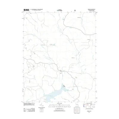
2011 Map of Shook
USGS Topo · Published 2011About this map
Shook serves as the central hub of this eastern Missouri landscape, where the confluence of Shook Creek and Little Creek meets a network of local roads including State Hwy D. The terrain is defined by the significant southern reach of Lake Wappapello, which creates a jagged shoreline near Lost Creek Landing. This area shows a distinct pattern of small, family-named landmarks and water bodies, such as Lottes Lake, Spaugh Pond, and Round Pond, indicating a history of local land use and water management.
Find a feature on this map
39 named features on this map. Tap any name to fly to it.
Don’t see what you’re looking for? This feature index may not catch every label — zoom into the map to look around manually.
Map Details
Editions of this 2011 Shook Map
This is the sole edition of this map. No revisions or reprints were ever made.
Other maps of this area

1934 · Greenville
USGS Topo · 1:62,500

1934 · Puxico
USGS Topo · 1:62,500

1935 · Poplar Bluff
USGS Topo · 1:62,500

1935 · Zalma
USGS Topo · 1:62,500

1939 · Greenville
USGS Topo · 1:62,500

1939 · Puxico
USGS Topo · 1:62,500

1939 · Zalma
USGS Topo · 1:62,500

1939 · Poplar Bluff
USGS Topo · 1:62,500

1949 · Rolla
USGS Topo · 1:250,000

1949 · Poplar Bluff
USGS Topo · 1:62,500