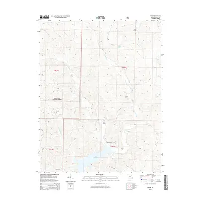
2015 Map of Shook
USGS Topo · Published 2015About this map
Shook sits at a geographic crossroads in Wayne County where the rugged timberlands of the Mark Twain National Forest meet the upper reaches of Lake Wappapello. The settlement pattern is defined by family legacy and water, with small communities like Lost Creek Landing and numerous family burying grounds including Thornton Cemetery, Shiloh Cemetery, Helm Cemetery, and Jones Cemetery scattered across the landscape. The terrain is deeply carved by water, notably the E Fork Lost Cr and W Fork Lost Cr, which dictate the winding paths of rural routes like State Hwy D. The map also captures several distinct landmarks such as Childers Hill and Nagle Hollow, reflecting the topographical character of the Missouri Ozarks. This survey is a record of a quiet, rural interior where small lakes like Lottes Lake and named springs like Blue Hole Br provided essential water resources for local residents and industry.
Find a feature on this map
46 named features on this map. Tap any name to fly to it.
Don’t see what you’re looking for? This feature index may not catch every label — zoom into the map to look around manually.
Map Details
Editions of this 2015 Shook Map
This is the sole edition of this map. No revisions or reprints were ever made.
Other maps of this area

1934 · Greenville
USGS Topo · 1:62,500

1934 · Puxico
USGS Topo · 1:62,500

1935 · Poplar Bluff
USGS Topo · 1:62,500

1935 · Zalma
USGS Topo · 1:62,500

1939 · Greenville
USGS Topo · 1:62,500

1939 · Puxico
USGS Topo · 1:62,500

1939 · Zalma
USGS Topo · 1:62,500

1939 · Poplar Bluff
USGS Topo · 1:62,500

1949 · Rolla
USGS Topo · 1:250,000

1949 · Poplar Bluff
USGS Topo · 1:62,500