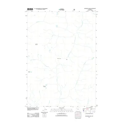
2012 Map of Shoshone Pass
USGS Topo · Published 2012About this map
Shoshone Pass serves as a central divide in this high-altitude landscape of the Absaroka Range, where the headwaters of several major drainage systems originate. The map documents the complex hydrology of the region, including the S Fork Shoshone River flowing northeast and the S Buffalo Fork in the northwest. Significant geological and glacial features are recorded, most notably the DuNoir Glacier situated below Coffin Butte. The rugged character of the terrain is further defined by Crescent Mountain and the deep incision of Waterfalls Canyon. Human presence is minimal, marked only by the isolated Stock Cabin near the pass, highlighting the area's remote nature in the early 21st century. High-altitude water bodies such as Watkins Lakes, Boday Lake, and Frozen Lake are scattered throughout the peaks, indicating a landscape shaped by persistent ice and snow.
Find a feature on this map
19 named features on this map. Tap any name to fly to it.
Don’t see what you’re looking for? This feature index may not catch every label — zoom into the map to look around manually.
Map Details
Editions of this 2012 Shoshone Pass Map
This is the sole edition of this map. No revisions or reprints were ever made.
Other maps of this area

1905 · Younts Peak
USGS Topo · 1:125,000

1907 · Younts Peak
USGS Topo · 1:125,000

1955 · Thermopolis
USGS Topo · 1:250,000

1956 · Esmond Park
USGS Topo · 1:24,000

1956 · Shoshone Pass
USGS Topo · 1:24,000

1956 · Ramshorn Peak
USGS Topo · 1:24,000

1956 · Five Pockets
USGS Topo · 1:24,000

1956 · Kisinger Lakes
USGS Topo · 1:24,000
1956 · Dundee Meadows
USGS Topo · 1:24,000

1958 · Thermopolis
USGS Topo · 1:250,000