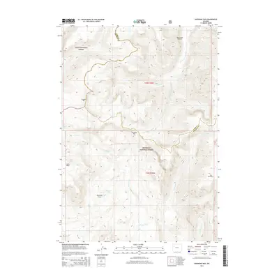
2015 Map of Shoshone Pass
USGS Topo · Published 2015About this map
Shoshone Pass sits at the high-elevation divide between the Park and Fremont county lines, serving as a critical topographical waypoint within the Shoshone National Forest. This high-altitude landscape is defined by its complex hydrology, where the S Fork Shoshone River and S Buffalo Fork drain separate basins. Notable landmarks include the prominent Crescent Mtn and the unique formation of The Ramshorn to the southeast.
Find a feature on this map
24 named features on this map. Tap any name to fly to it.
Don’t see what you’re looking for? This feature index may not catch every label — zoom into the map to look around manually.
Map Details
Editions of this 2015 Shoshone Pass Map
This is the sole edition of this map. No revisions or reprints were ever made.
Other maps of this area

1905 · Younts Peak
USGS Topo · 1:125,000

1907 · Younts Peak
USGS Topo · 1:125,000

1955 · Thermopolis
USGS Topo · 1:250,000

1956 · Esmond Park
USGS Topo · 1:24,000

1956 · Shoshone Pass
USGS Topo · 1:24,000

1956 · Ramshorn Peak
USGS Topo · 1:24,000

1956 · Five Pockets
USGS Topo · 1:24,000

1956 · Kisinger Lakes
USGS Topo · 1:24,000
1956 · Dundee Meadows
USGS Topo · 1:24,000

1958 · Thermopolis
USGS Topo · 1:250,000