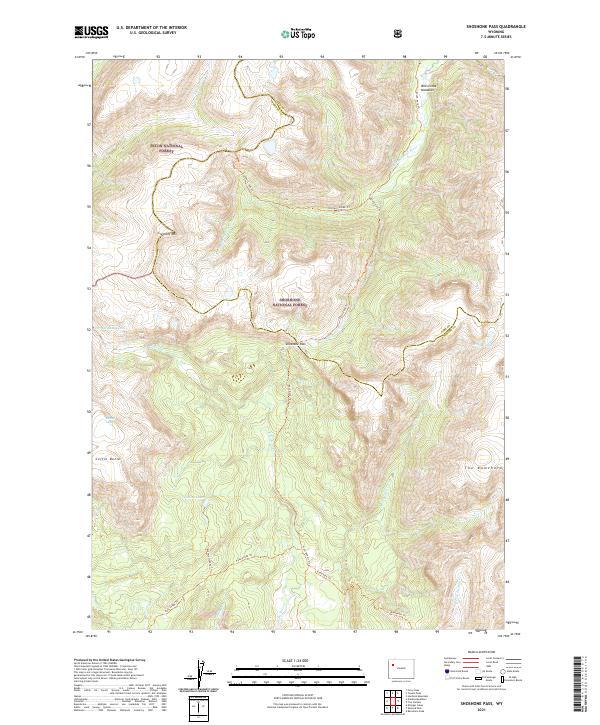
2021 Map of Shoshone Pass
USGS Topo · Published 2021About this map
Shoshone Pass sits at the dramatic intersection of the Shoshone National Forest and the Teton National Forest, marking a critical divide in the Wyoming wilderness. The landscape is defined by the high-altitude headwaters of major Western water systems, including the Snake River Headwaters Wild and Scenic River and the South Fork Shoshone River. This 2021 survey reveals a complex network of backcountry trails like the South Fork Trl and East Dunoir Trl that navigate around prominent geological features such as Crescent Mtn and the sharp profile of The Ramshorn. Hidden among the high ridges are remote water bodies and remnants of glacial activity, most notably the DuNoir Glacier and the secluded Watkins Lakes. The map documents a territory where topography dictates travel, from the open Bliss Creek Meadows to the steep descent near Coffin Butte.
Find a feature on this map
33 named features on this map. Tap any name to fly to it.
Don’t see what you’re looking for? This feature index may not catch every label — zoom into the map to look around manually.
Map Details
Editions of this 2021 Shoshone Pass Map
This is the sole edition of this map. No revisions or reprints were ever made.
Other maps of this area

1905 · Younts Peak
USGS Topo · 1:125,000

1907 · Younts Peak
USGS Topo · 1:125,000

1955 · Thermopolis
USGS Topo · 1:250,000

1956 · Esmond Park
USGS Topo · 1:24,000

1956 · Shoshone Pass
USGS Topo · 1:24,000

1956 · Ramshorn Peak
USGS Topo · 1:24,000

1956 · Five Pockets
USGS Topo · 1:24,000

1956 · Kisinger Lakes
USGS Topo · 1:24,000
1956 · Dundee Meadows
USGS Topo · 1:24,000

1958 · Thermopolis
USGS Topo · 1:250,000