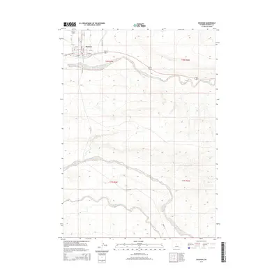
2015 Map of Shoshoni
USGS Topo · Published 2015About this map
The town of Shoshoni serves as a focal point in this high-desert landscape, situated at a junction of regional transport routes. The town’s grid is clearly defined by residential streets such as Idaho St and Wyoming St, supporting the local community and the nearby Shoshoni Airport. The surrounding terrain is dominated by the complex drainage systems of Poison Creek, Muskrat Creek, and Dry Cheyenne Creek, which carve distinctive patterns across the township lines of t38n r94w and t37n r94w.
Find a feature on this map
27 named features on this map. Tap any name to fly to it.
Don’t see what you’re looking for? This feature index may not catch every label — zoom into the map to look around manually.
Map Details
Editions of this 2015 Shoshoni Map
This is the sole edition of this map. No revisions or reprints were ever made.
Other maps of this area

1950 · Bonneville SW
USGS Topo · 1:24,000

1951 · Fuller Reservoir
USGS Topo · 1:24,000

1951 · Indian Butte
USGS Topo · 1:24,000

1951 · Hidden Valley
USGS Topo · 1:24,000

1951 · Bonneville
USGS Topo · 1:24,000

1951 · Shoshoni
USGS Topo · 1:24,000

1952 · Ocla Draw
USGS Topo · 1:24,000

1952 · Picard Ranch
USGS Topo · 1:24,000

1952 · Haybarn Hill
USGS Topo · 1:24,000

1955 · Thermopolis
USGS Topo · 1:250,000