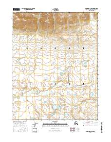
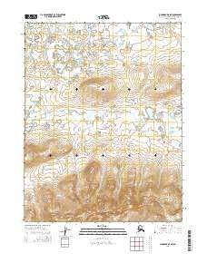
2016 Map of Shungnak C-4 NW
USGS Topo · Published 2016About this map
The Rabbit River dominates the central and southern reaches of this interior Alaskan landscape, winding through a complex system of low-lying wetlands and small unnamed lakes. Located within the Northwest Arctic Borough, the terrain transitions from these water-rich plains in the south toward significantly higher elevations in the north. The mapping of t16n r4e and t16n r5e reveals steep, densely contoured ridges that stand in sharp contrast to the meandering river valley below. This environment, captured in 2016, reflects the characteristic hydrology of the region, where the Rabbit River serves as the primary drainage feature for the surrounding mountain runoff.
Find a feature on this map
7 named features on this map. Tap any name to fly to it.
Don’t see what you’re looking for? This feature index may not catch every label — zoom into the map to look around manually.
Map Details
Editions of this 2016 Shungnak C-4 NW Map
This is the sole edition of this map. No revisions or reprints were ever made.
Other maps of this area

1951 · Shungnak
USGS Topo · 1:250,000

1955 · Shungnak
USGS Topo · 1:250,000

1955 · Shungnak D-4
USGS Topo · 1:63,360

1955 · Shungnak D-5
USGS Topo · 1:63,360

1964 · Shungnak
USGS Topo · 1:250,000
1985 · Shungnak C-5
USGS Topo · 1:63,360
1985 · Shungnak C-4
USGS Topo · 1:63,360
2015 · Shungnak D-5 SE
USGS Topo · 1:25,000
2015 · Shungnak D-4 SW
USGS Topo · 1:25,000
2016 · Shungnak C-5 NE
USGS Topo · 1:25,000