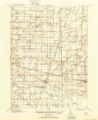
1915 Map of Siam
USGS Topo · Published 1951About this map
Attica Junction serves as a critical rail intersection where the Baltimore and Ohio and Pennsylvania railroads cross, anchoring the rural economy of Seneca and Huron Counties. This early 20th-century landscape is defined by a dense grid of district schools, including uniquely named sites like Podunk School and English School, alongside small agrarian settlements such as Fireside, Flat Rock, and West Lodi. The surveying also marks the West Boundary Connecticut Reserve, a significant historical survey line that influenced land division in the region. Numerous family-named drainage ditches, such as Royer Ditch and Eicholtz Ditch, reflect the intensive efforts to manage the water table for agriculture. Genealogists will find interest in the numerous rural schoolhouses and small sidings like Scipio Siding that once connected isolated farmsteads to wider markets.
Find a feature on this map
90 named features on this map. Tap any name to fly to it.
Don’t see what you’re looking for? This feature index may not catch every label — zoom into the map to look around manually.
Map Details
Editions of this 1915 Siam Map
2 editions found
Other maps of this area

1901 · Bellevue
USGS Topo · 1:62,500

1901 · Fremont
USGS Topo · 1:62,500

1903 · Bellevue
USGS Topo · 1:62,500

1903 · Fremont
USGS Topo · 1:62,500

1904 · Sandusky
USGS Topo · 1:62,500

1906 · Sycamore
USGS Topo · 1:62,500

1906 · Tiffin
USGS Topo · 1:62,500

1915 · Norwalk
USGS Topo · 1:62,500

1915 · Siam
USGS Topo · 1:62,500

1915 · Bucyrus
USGS Topo · 1:62,500