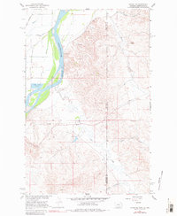
1966 Map of Sidney NE
USGS Topo · Published 1980About this map
The Yellowstone River cuts through the western edge of this landscape, marking a sharp boundary between the river bottom and the broken terrain of the Badlands to the east. In the mid-1960s, this border region between Montana and North Dakota supported a diverse range of infrastructure, from the Great Northern rail line and its elevated embankments to the Pipeline corridors crossing the state line. Industrial activity is evident in the northern draws, where the Tidwell Mine and various other Mines and Prospects suggest a history of resource extraction near Cheney coulee.
Find a feature on this map
29 named features on this map. Tap any name to fly to it.
Don’t see what you’re looking for? This feature index may not catch every label — zoom into the map to look around manually.
Map Details
Editions of this 1966 Sidney NE Map
2 editions found
Other maps of this area

1909 · Glendive
USGS Topo · 1:250,000

1953 · Watford City
USGS Topo · 1:250,000

1954 · Glendive
USGS Topo · 1:250,000

1957 · Glendive
USGS Topo · 1:250,000

1957 · Watford City
USGS Topo · 1:250,000

1958 · Glendive
USGS Topo · 1:250,000

1966 · Piche
USGS Topo · 1:24,000

1966 · Sidney NE
USGS Topo · 1:24,000

1966 · Sidney
USGS Topo · 1:24,000

1967 · Watford City
USGS Topo · 1:250,000