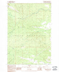
1988 Map of Sidwalter Buttes
USGS Topo · Published 1988About this map
The Warm Springs Indian Reservation in northern Oregon is defined here by its complex drainage systems and volcanic topography. The landscape is oriented around the Warm Springs River and its tributaries, including the South Fork Warm Springs River and Badger Creek. A notable historical marker on this map is the Old Indian Reservation Boundary (Forbes Line 1887), which traces a former surveyor's line along the northwestern edge of the sheet.
Find a feature on this map
20 named features on this map. Tap any name to fly to it.
Don’t see what you’re looking for? This feature index may not catch every label — zoom into the map to look around manually.
Map Details
Editions of this 1988 Sidwalter Buttes Map
2 editions found
Other maps of this area

1924 · Mount Hood
USGS Topo · 1:125,000

1927 · Mount Hood
USGS Topo · 1:125,000

1927 · Mt. Jefferson
USGS Topo · 1:125,000

1928 · Madras
USGS Topo · 1:125,000

1930 · Mt. Jefferson
USGS Topo · 1:125,000

1930 · Dufur
USGS Topo · 1:125,000

1931 · Madras
USGS Topo · 1:125,000

1934 · Dufur
USGS Topo · 1:125,000

1953 · The Dalles
USGS Topo · 1:250,000

1955 · Bend
USGS Topo · 1:250,000