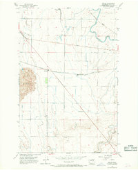
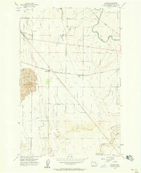
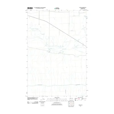
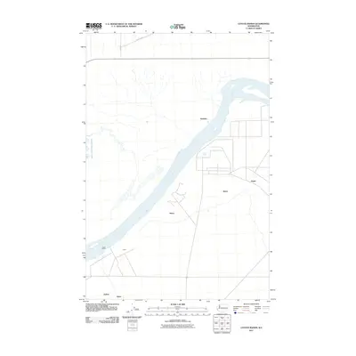
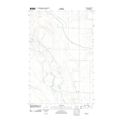
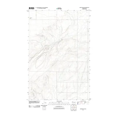
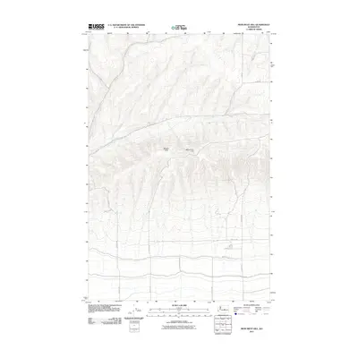
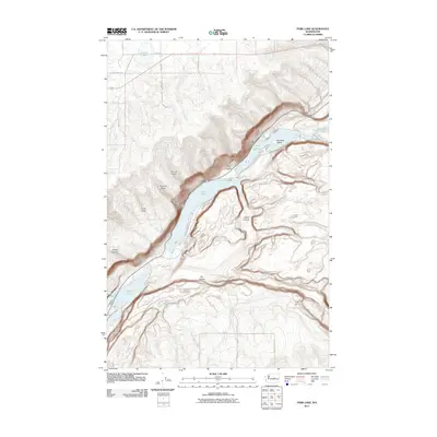
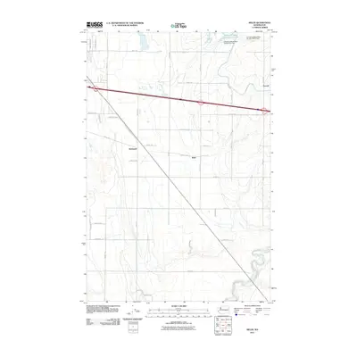
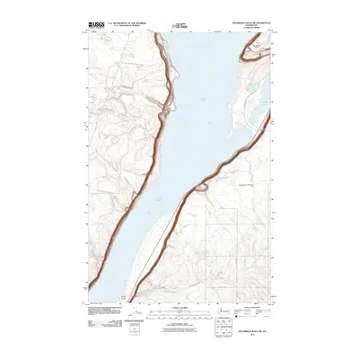
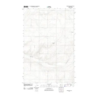
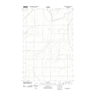
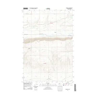
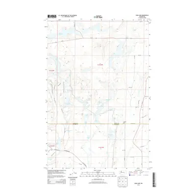
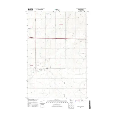
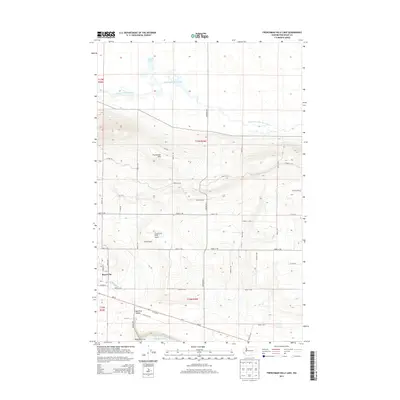
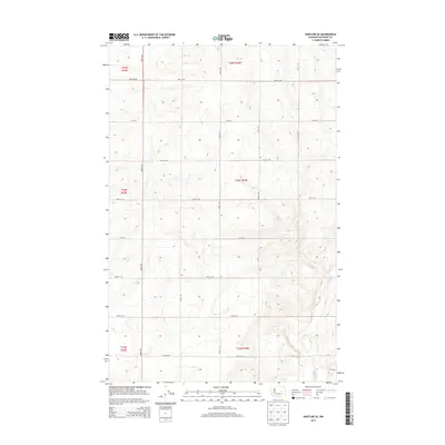
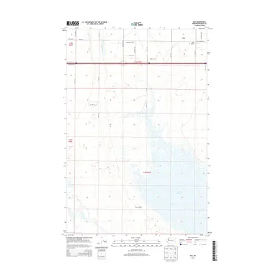
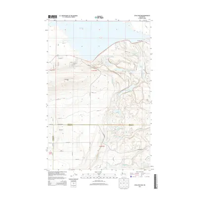
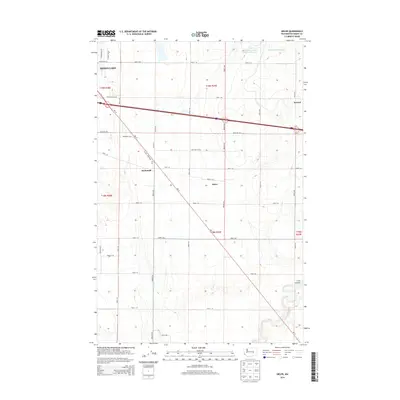
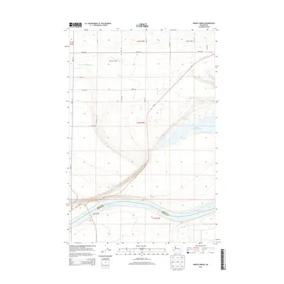
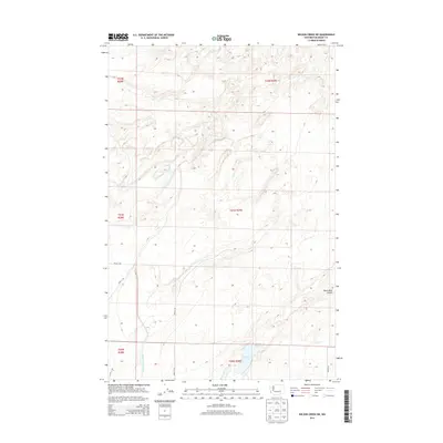
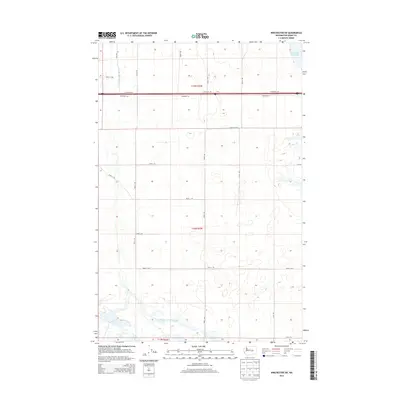
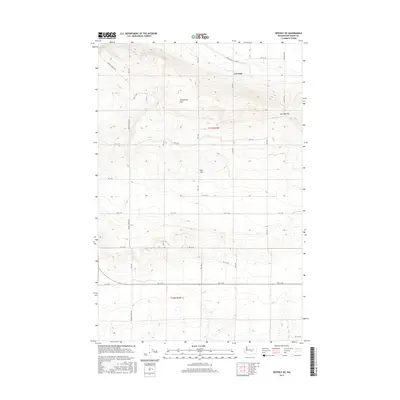
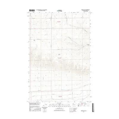
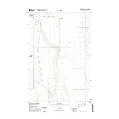
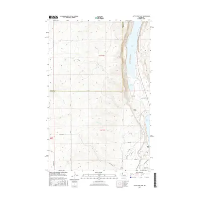
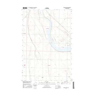
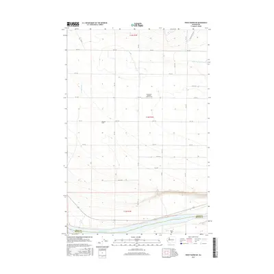
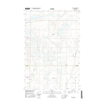
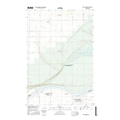
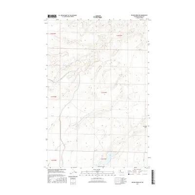
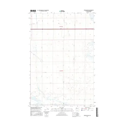
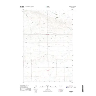
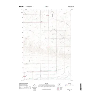
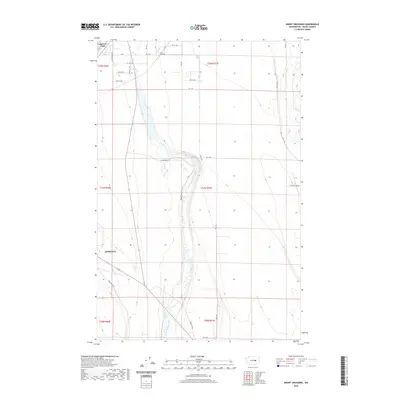
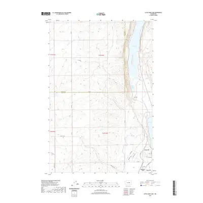
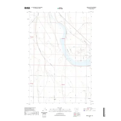
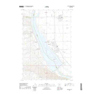
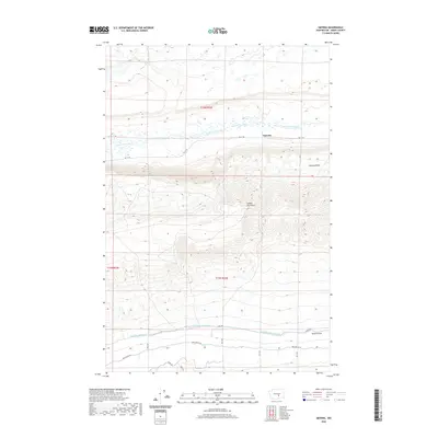
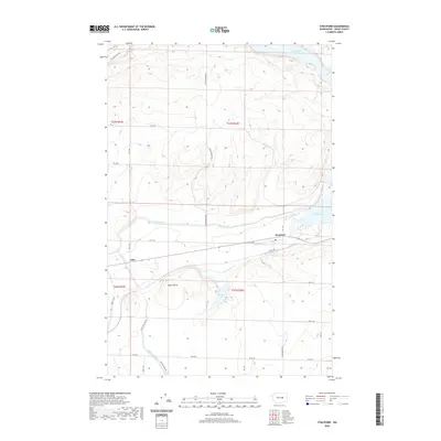
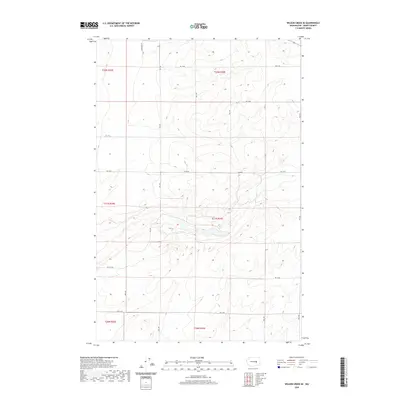
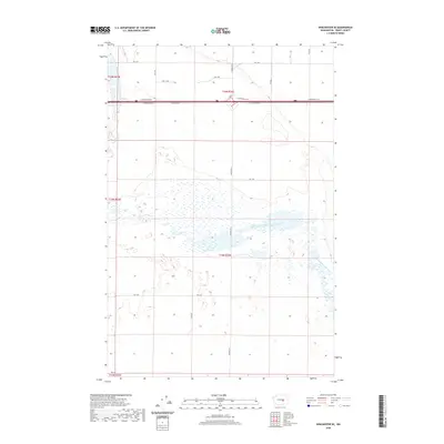
1956 Map of Sieler
USGS Topo · Published 1968About this map
Agricultural development and industrial infrastructure define this mid-century landscape in Grant County. The Chicago Milwaukee St Paul and Pacific railroad cuts a diagonal path across the terrain, passing through the small settlements of McDonald and Sieler. This period shows the heavy influence of irrigation and industry on the arid landscape, most notably with the massive East Low Canal and its associated siphons and pipelines that distribute water through the region. To the north, the Sugar Beet Refinery stands as a central landmark of the local economy. The western edge of the survey is dominated by a shifting natural landscape of Sand Dunes, providing a stark contrast to the surveyed grid of Base Line Road and the entertainment found at the local Drive-in Theater.
Find a feature on this map
16 named features on this map. Tap any name to fly to it.
Don’t see what you’re looking for? This feature index may not catch every label — zoom into the map to look around manually.
Map Details
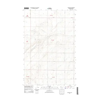
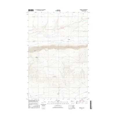
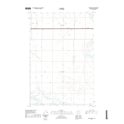
Editions of this 1956 Sieler Map
Historical Maps of Moses Lake Through Time
269 maps found

1910 Winchester
Grant County, WA

1911 Red Rock
Grant County, WA

1917 Priest Rapids
Grant County, WA

1923 Corfu
Grant County, WA

1948 Priest Rapids
Grant County, WA

1950 Smyrna
Grant County, WA

1951 Corfu
Grant County, WA

1951 Priest Rapids
Grant County, WA

1951 Smyrna
Grant County, WA

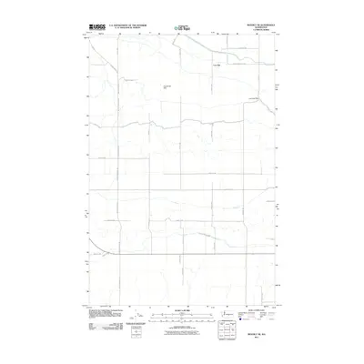
1954 Beverly NE
Grant County, WA

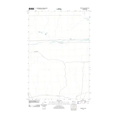
1954 Beverly SE
Grant County, WA

1954 Soda Lake
Grant County, WA

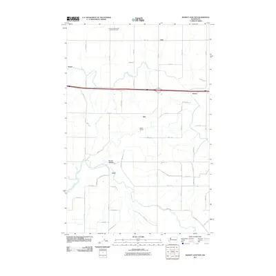
1956 Bassett Junction
Grant County, WA

1956 Ephrata SW
Grant County, WA

1956 Gloyd
Grant County, WA

1956 Grant Orchards
Grant County, WA

1956 Mae
Grant County, WA

1956 Moses Lake NW
Grant County, WA

1956 Moses Lake South
Grant County, WA

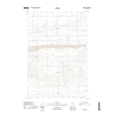
1956 Sieler
Grant County, WA

1956 Stratford
Grant County, WA

1956 Wheeler NE
Grant County, WA

1956 Wilson Creek NW
Grant County, WA

1956 Wilson Creek SE
Grant County, WA

1956 Wilson Creek SW
Grant County, WA

1956 Winchester NE
Grant County, WA

1956 Winchester SE
Grant County, WA

1965 Beverly NE
Grant County, WA

1965 Beverly SE
Grant County, WA

1965 Corfu
Grant County, WA

1965 Park Lake
Grant County, WA

1965 Priest Rapids
Grant County, WA

1965 Smyrna
Grant County, WA

1966 Appledale
Grant County, WA

1966 Babcock Ridge
Grant County, WA

1966 Evergreen Ridge
Grant County, WA

1966 Monument Hill
Grant County, WA

1966 Winchester
Grant County, WA

1966 Winchester NE
Grant County, WA

1966 Winchester SE
Grant County, WA

1966 Winchester SW
Grant County, WA

1968 Hartline NW
Grant County, WA

1968 Hartline SE
Grant County, WA

1968 Hartline SW
Grant County, WA

1968 Steamboat Rock SE
Grant County, WA

1968 Steamboat Rock SW
Grant County, WA

1979 Priest Rapids
Grant County, WA

1986 Corfu
Grant County, WA

1986 Coyote Rapids
Grant County, WA

1986 Frenchman Hills Lake
Grant County, WA

1986 Little Soap Lake
Grant County, WA

1986 Locke Island
Grant County, WA

1986 O'Sullivan Dam
Grant County, WA

1986 Priest Rapids NE
Grant County, WA

1986 Royal Camp
Grant County, WA

1986 Smyrna
Grant County, WA

1986 Vernita Bridge
Grant County, WA

1986 Wahatis Peak
Grant County, WA

1999 Mae
Grant County, WA
2011 Appledale
Grant County, WA
2011 Babcock Ridge
Grant County, WA
2011 Bassett Junction
Grant County, WA
2011 Beverly NE
Grant County, WA
2011 Beverly SE
Grant County, WA
2011 Corfu
Grant County, WA
2011 Coyote Rapids
Grant County, WA
2011 Ephrata SW
Grant County, WA
2011 Evergreen Ridge
Grant County, WA
2011 Frenchman Hills Lake
Grant County, WA
2011 Gloyd
Grant County, WA
2011 Grant Orchards
Grant County, WA
2011 Hartline NW
Grant County, WA
2011 Hartline SE
Grant County, WA
2011 Hartline SW
Grant County, WA
2011 Little Soap Lake
Grant County, WA
2011 Locke Island
Grant County, WA
2011 Mae
Grant County, WA
2011 Monument Hill
Grant County, WA
2011 Moses Lake NW
Grant County, WA
2011 Moses Lake South
Grant County, WA
2011 O'Sullivan Dam
Grant County, WA
2011 Park Lake
Grant County, WA
2011 Priest Rapids
Grant County, WA
2011 Priest Rapids NE
Grant County, WA
2011 Royal Camp
Grant County, WA
2011 Sieler
Grant County, WA
2011 Smyrna
Grant County, WA
2011 Soda Lake
Grant County, WA
2011 Steamboat Rock SE
Grant County, WA
2011 Steamboat Rock SW
Grant County, WA
2011 Stratford
Grant County, WA
2011 Vernita Bridge
Grant County, WA
2011 Wahatis Peak
Grant County, WA
2011 Wheeler NE
Grant County, WA
2011 Wilson Creek NW
Grant County, WA
2011 Wilson Creek SE
Grant County, WA

2011 Wilson Creek SW
Grant County, WA
2011 Winchester
Grant County, WA
2011 Winchester NE
Grant County, WA
2011 Winchester SE
Grant County, WA
2011 Winchester SW
Grant County, WA
2013 Beverly NE
Grant County, WA
2013 Beverly SE
Grant County, WA
2013 Corfu
Grant County, WA
2013 Royal Camp
Grant County, WA
2013 Smyrna
Grant County, WA
2013 Soda Lake
Grant County, WA
2013 Wahatis Peak
Grant County, WA
2014 Appledale
Grant County, WA
2014 Babcock Ridge
Grant County, WA
2014 Bassett Junction
Grant County, WA
2014 Coyote Rapids
Grant County, WA
2014 Ephrata SW
Grant County, WA
2014 Evergreen Ridge
Grant County, WA
2014 Frenchman Hills Lake
Grant County, WA
2014 Gloyd
Grant County, WA
2014 Grant Orchards
Grant County, WA
2014 Hartline NW
Grant County, WA
2014 Hartline SE
Grant County, WA
2014 Hartline SW
Grant County, WA
2014 Little Soap Lake
Grant County, WA
2014 Locke Island
Grant County, WA
2014 Mae
Grant County, WA
2014 Monument Hill
Grant County, WA
2014 Moses Lake NW
Grant County, WA
2014 Moses Lake South
Grant County, WA
2014 O'Sullivan Dam
Grant County, WA
2014 Park Lake
Grant County, WA
2014 Priest Rapids
Grant County, WA
2014 Priest Rapids NE
Grant County, WA
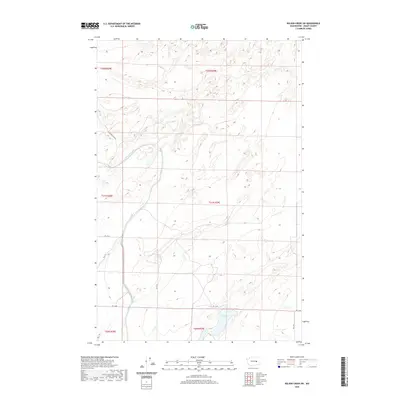
2014 Sieler
Grant County, WA
2014 Steamboat Rock SE
Grant County, WA
2014 Steamboat Rock SW
Grant County, WA
2014 Stratford
Grant County, WA
2014 Vernita Bridge
Grant County, WA
2014 Wheeler NE
Grant County, WA
2014 Wilson Creek NW
Grant County, WA
2014 Wilson Creek SE
Grant County, WA
2014 Wilson Creek SW
Grant County, WA
2014 Winchester
Grant County, WA
2014 Winchester NE
Grant County, WA
2014 Winchester SE
Grant County, WA
2014 Winchester SW
Grant County, WA
2017 Appledale
Grant County, WA
2017 Babcock Ridge
Grant County, WA
2017 Bassett Junction
Grant County, WA
2017 Beverly NE
Grant County, WA
2017 Beverly SE
Grant County, WA
2017 Corfu
Grant County, WA
2017 Coyote Rapids
Grant County, WA
2017 Ephrata SW
Grant County, WA
2017 Evergreen Ridge
Grant County, WA
2017 Frenchman Hills Lake
Grant County, WA
2017 Gloyd
Grant County, WA
2017 Grant Orchards
Grant County, WA
2017 Hartline NW
Grant County, WA
2017 Hartline SE
Grant County, WA
2017 Hartline SW
Grant County, WA
2017 Little Soap Lake
Grant County, WA
2017 Locke Island
Grant County, WA
2017 Mae
Grant County, WA
2017 Monument Hill
Grant County, WA
2017 Moses Lake NW
Grant County, WA
2017 Moses Lake South
Grant County, WA
2017 O'Sullivan Dam
Grant County, WA

2017 Park Lake
Grant County, WA
2017 Priest Rapids
Grant County, WA
2017 Priest Rapids NE
Grant County, WA
2017 Royal Camp
Grant County, WA
2017 Sieler
Grant County, WA
2017 Smyrna
Grant County, WA
2017 Soda Lake
Grant County, WA
2017 Steamboat Rock SE
Grant County, WA
2017 Steamboat Rock SW
Grant County, WA
2017 Stratford
Grant County, WA
2017 Vernita Bridge
Grant County, WA
2017 Wahatis Peak
Grant County, WA
2017 Wheeler NE
Grant County, WA
2017 Wilson Creek NW
Grant County, WA

2017 Wilson Creek SE
Grant County, WA
2017 Wilson Creek SW
Grant County, WA
2017 Winchester
Grant County, WA
2017 Winchester NE
Grant County, WA
2017 Winchester SE
Grant County, WA
2017 Winchester SW
Grant County, WA
2020 Appledale
Grant County, WA
2020 Babcock Ridge
Grant County, WA
2020 Bassett Junction
Grant County, WA
2020 Beverly NE
Grant County, WA
2020 Beverly SE
Grant County, WA
2020 Corfu
Grant County, WA
2020 Coyote Rapids
Grant County, WA
2020 Ephrata SW
Grant County, WA
2020 Evergreen Ridge
Grant County, WA
2020 Frenchman Hills Lake
Grant County, WA
2020 Gloyd
Grant County, WA
2020 Grant Orchards
Grant County, WA
2020 Hartline NW
Grant County, WA
2020 Hartline SE
Grant County, WA
2020 Hartline SW
Grant County, WA
2020 Little Soap Lake
Grant County, WA
2020 Locke Island
Grant County, WA
2020 Mae
Grant County, WA
2020 Monument Hill
Grant County, WA
2020 Moses Lake NW
Grant County, WA
2020 Moses Lake South
Grant County, WA
2020 O'Sullivan Dam
Grant County, WA
2020 Park Lake
Grant County, WA
2020 Priest Rapids
Grant County, WA
2020 Priest Rapids NE
Grant County, WA
2020 Royal Camp
Grant County, WA
2020 Sieler
Grant County, WA
2020 Smyrna
Grant County, WA
2020 Soda Lake
Grant County, WA
2020 Steamboat Rock SE
Grant County, WA
2020 Steamboat Rock SW
Grant County, WA
2020 Stratford
Grant County, WA
2020 Vernita Bridge
Grant County, WA
2020 Wahatis Peak
Grant County, WA
2020 Wheeler NE
Grant County, WA

2020 Wilson Creek NW
Grant County, WA
2020 Wilson Creek SE
Grant County, WA
2020 Wilson Creek SW
Grant County, WA
2020 Winchester
Grant County, WA
2020 Winchester NE
Grant County, WA
2020 Winchester SE
Grant County, WA
2020 Winchester SW
Grant County, WA

2023 Appledale
Grant County, WA

2023 Babcock Ridge
Grant County, WA

2023 Bassett Junction
Grant County, WA

2023 Beverly NE
Grant County, WA

2023 Beverly SE
Grant County, WA

2023 Corfu
Grant County, WA

2023 Coyote Rapids
Grant County, WA

2023 Ephrata SW
Grant County, WA

2023 Evergreen Ridge
Grant County, WA

2023 Frenchman Hills Lake
Grant County, WA

2023 Gloyd
Grant County, WA

2023 Grant Orchards
Grant County, WA

2023 Hartline NW
Grant County, WA

2023 Hartline SE
Grant County, WA

2023 Hartline SW
Grant County, WA

2023 Little Soap Lake
Grant County, WA

2023 Locke Island
Grant County, WA

2023 Mae
Grant County, WA

2023 Monument Hill
Grant County, WA

2023 Moses Lake NW
Grant County, WA

2023 Moses Lake South
Grant County, WA

2023 O'Sullivan Dam
Grant County, WA

2023 Park Lake
Grant County, WA

2023 Priest Rapids
Grant County, WA

2023 Priest Rapids NE
Grant County, WA

2023 Royal Camp
Grant County, WA

2023 Sieler
Grant County, WA

2023 Smyrna
Grant County, WA

2023 Soda Lake
Grant County, WA

2023 Steamboat Rock SE
Grant County, WA

2023 Steamboat Rock SW
Grant County, WA

2023 Stratford
Grant County, WA

2023 Vernita Bridge
Grant County, WA

2023 Wahatis Peak
Grant County, WA

2023 Wheeler NE
Grant County, WA

2023 Wilson Creek NW
Grant County, WA

2023 Wilson Creek SE
Grant County, WA

2023 Wilson Creek SW
Grant County, WA

2023 Winchester
Grant County, WA

2023 Winchester NE
Grant County, WA

2023 Winchester SE
Grant County, WA

2023 Winchester SW
Grant County, WA