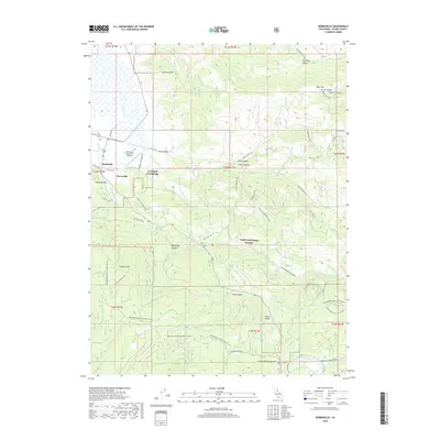
2018 Map of Sierraville
USGS Topo · Published 2018About this map
Sierraville and the neighboring settlement of Randolph sit at the southern edge of the Antelope Valley, where mountain drainages begin their descent into the Sierra Valley. The landscape transitions sharply from the level airfield at Sierraville Dearwater Airport to the high elevations of Harding Point and Randolph Hill. This 2018 survey reveals a terrain deeply carved by water and frequented by recreationists, with Cold Stream and Cottonwood Cr winding through the canyons of the Tahoe National Forest.
Find a feature on this map
56 named features on this map. Tap any name to fly to it.
Don’t see what you’re looking for? This feature index may not catch every label — zoom into the map to look around manually.
Map Details
Editions of this 2018 Sierraville Map
This is the sole edition of this map. No revisions or reprints were ever made.
Other maps of this area

1890 · Sierraville
USGS Topo · 1:125,000

1891 · Truckee
USGS Topo · 1:125,000

1892 · Sierraville
USGS Topo · 1:125,000

1893 · Truckee
USGS Topo · 1:125,000

1894 · Sierraville
USGS Topo · 1:125,000

1895 · Truckee
USGS Topo · 1:125,000

1932 · Truckee
USGS Topo · 1:96,000

1940 · Truckee
USGS Topo · 1:125,000

1955 · Loyalton
USGS Topo · 1:62,500
1955 · Donner Pass
USGS Topo · 1:62,500