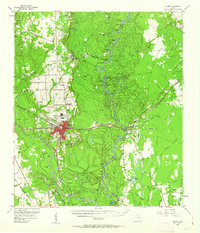
1955 Map of Silsbee
USGS Topo · Published 1963About this map
The Neches River forms a serpentine boundary between Hardin and Jasper counties, defining a landscape of dense bottomlands and timber-rich baygalls. The city of Silsbee serves as the regional hub, situated at the junction of the Gulf Colorado and Santa Fe and the Texas Southern and New Orleans Pacific railroads. The era's industrial character is clear through the sprawling Silsbee Oil Field and the Beech Creek Oil Field, while the river's influence is seen in numerous named eddies and bends like Gourd Vine Eddy and Cookiebur Bend. Genealogists will find interest in localized family landmarks such as Gore Cem and the Hook Cem near South Hampton. The map also captures several fire lookout towers, including the Smart School Fire Lookout Tower, highlighting the vital importance of forestry management in this section of East Texas during the mid-1950s.
Find a feature on this map
96 named features on this map. Tap any name to fly to it.
Don’t see what you’re looking for? This feature index may not catch every label — zoom into the map to look around manually.
Map Details
Editions of this 1955 Silsbee Map
Other maps of this area

1926 · Lakeview
USGS Topo · 1:24,000

1926 · Texla
USGS Topo · 1:24,000

1932 · Beaumont
USGS Topo · 1:62,500

1943 · Texla
USGS Topo · 1:24,000

1952 · Lake Charles
USGS Topo · 1:250,000

1954 · Lake Charles
USGS Topo · 1:250,000

1954 · Beaumont
USGS Topo · 1:250,000

1955 · Silsbee
USGS Topo · 1:62,500

1955 · Kountze
USGS Topo · 1:62,500

1955 · Bessmay
USGS Topo · 1:62,500