1936 Map of Silvertip
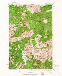
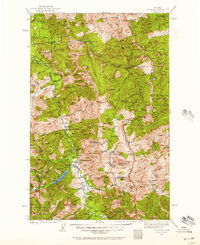
USGS Topo · Published 1964About this map
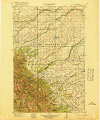
Big Salmon Lake and the White River define the lower drainage of this mountain landscape as it was surveyed in the 1930s. The region is characterized by high-elevation ridges like Dean Ridge and the Limestone Wall, where human presence is marked by isolated outposts such as Limestone Cabin, Dean Camp, and the Pentagon Cabin. The presence of several remote airstrips, including the Meadow Creek Landing Field and Black Bear Landing Field, suggests a reliance on aerial access for management and supply in the backcountry.
Find a feature on this map
137 named features on this map. Tap any name to fly to it.
Don’t see what you’re looking for? This feature index may not catch every label — zoom into the map to look around manually.
Map Details
Editions of this 1936 Silvertip Map
3 editions found
Other maps of this area

1902 · Ovando
USGS Topo · 1:125,000

1903 · Saypo
USGS Topo · 1:125,000

1903 · Coopers Lake
USGS Topo · 1:125,000

1905 · Ovando
USGS Topo · 1:125,000

1913 · Marias Pass
USGS Topo · 1:125,000

1914 · Nyack
USGS Topo · 1:125,000

1914 · Heart Butte
USGS Topo · 1:125,000
1918 · Heart Butte
USGS Topo · 1:125,000

1921 · Elbow Lake
USGS Topo · 1:125,000

1936 · Silvertip
USGS Topo · 1:96,000