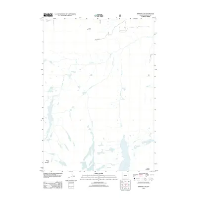
2012 Map of Simpson Lake
USGS Topo · Published 2012About this map
Windy Mountain and Square Top Mountain anchor this high-elevation landscape in Fremont County, where a complex network of glacial lakes and alpine drainages defines the terrain. The central hydrology is dominated by Jakeys Fork and its various tributaries, including Soapstone Cr and Moon Cr. These waters feed into a sequence of named basins such as Alice Lake, Boone Lake, and Simpson Lake, illustrating the post-glacial topography typical of the region.
Find a feature on this map
35 named features on this map. Tap any name to fly to it.
Don’t see what you’re looking for? This feature index may not catch every label — zoom into the map to look around manually.
Map Details
Editions of this 2012 Simpson Lake Map
This is the sole edition of this map. No revisions or reprints were ever made.
Other maps of this area

1905 · Younts Peak
USGS Topo · 1:125,000

1907 · Younts Peak
USGS Topo · 1:125,000

1909 · Fremont Peak
USGS Topo · 1:125,000

1955 · Thermopolis
USGS Topo · 1:250,000

1956 · Dubois
USGS Topo · 1:24,000

1956 · Warm Spring Mountain
USGS Topo · 1:24,000

1956 · Mason Draw
USGS Topo · 1:24,000

1958 · Thermopolis
USGS Topo · 1:250,000

1962 · Thermopolis
USGS Topo · 1:250,000
1968 · Union Peak
USGS Topo · 1:24,000