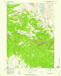
1968 Map of Union Peak
USGS Topo · Published 1972About this map
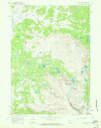
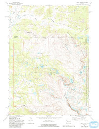
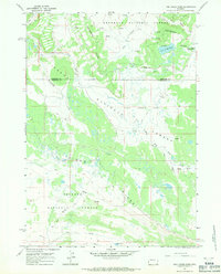
Union Peak stands as a central landmark in this 1968 study of the high-altitude frontier where the Continental Divide traverses the Wind River Range. The map details a complex hydrologic landscape where the headwaters of the South Fork Warm Spring Creek and South Fork Fish Creek begin their descent from the alpine heights. A significant cultural and historical marker is Union Pass, a vital corridor once used by early explorers and trappers, accompanied by the Union Pass Cow Camp and the Union Pass Road. The terrain is characterized by a dense concentration of glacial lakes, including Union Lake, Deep Lake, and Granite Lake, indicating a landscape shaped by ice and elevation. The boundary between the Shoshone National Forest, Teton National Forest, and Bridger National Forest meets here, marking a point of intersection for regional wilderness management and high-country grazing.
Find a feature on this map
45 named features on this map. Tap any name to fly to it.
Don’t see what you’re looking for? This feature index may not catch every label — zoom into the map to look around manually.
Map Details
Editions of this 1968 Union Peak Map
2 editions found
Other maps of this area
1905 · Younts Peak
USGS Topo · 1:125,000
1907 · Younts Peak
USGS Topo · 1:125,000
1909 · Fremont Peak
USGS Topo · 1:125,000

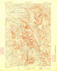
1955 · Thermopolis
USGS Topo · 1:250,000
1956 · Dubois
USGS Topo · 1:24,000
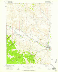
1956 · Warm Spring Mountain
USGS Topo · 1:24,000
1956 · Fish Lake
USGS Topo · 1:24,000

1958 · Thermopolis
USGS Topo · 1:250,000

1962 · Thermopolis
USGS Topo · 1:250,000
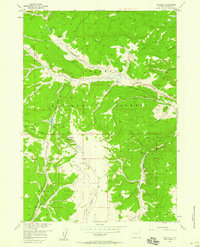
1967 · Fish Creek Park
USGS Topo · 1:24,000